City of Boroondara
| Państwo | |
|---|---|
| Stan | |
| Burmistrz | Cr Jack Wegman |
| Powierzchnia | 60 km² |
| Populacja • liczba ludności |
|
 | |
| Strona internetowa | |
| Portal | |
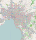
City of Boroondara – obszar samorządu lokalnego (ang. local government area), położony we wschodniej części aglomeracji Melbourne. Powstała w 1994 roku. Według danych z 2006 obszar ten zamieszkiwało 154 450 osób.
Dzielnice
- Ashburton
- Balwyn
- Balwyn North
- Camberwell
- Canterbury
- Glen Iris
- Hawthorn
- Hawthorn East
- Kew
- Kew East
- Mont Albert
- Surrey Hills
Zobacz też
Media użyte na tej stronie
Autor:
Autor: NordNordWest, Licencja: CC BY-SA 3.0 de
Location map of Victoria, Australia
State flag and government ensign (internal waters only) of Victoria.
Autor: Squiresy92 including elements from Sodacan, Licencja: CC BY-SA 4.0
The Coat of Arms of Victoria.
Map of Melbourne, Victoria (Australia), LGA of Boroondara City highlighted
Autor: Melburnian, Licencja: CC-BY-SA-3.0
Camberwell Town Hall in Camberwell (suburb of Melbourne), Victoria, Australia.


