City of Mitcham
| obszar samorządu lokalnego | |
 Melrose Park | |
| Państwo | |
|---|---|
| Stan | |
| Powierzchnia | 75,55 km² |
| Populacja (2001) • liczba ludności | 59 766 |
Położenie na mapie Adelaide | |
| Strona internetowa | |
| Portal | |
City of Mitcham – jednostka samorządowa wchodząca w skład aglomeracji Adelaide. Mitcham zostało założone w 1853 i był pierwszym samorządem terytorialnym założonym w stanie Australia Południowa po Adelaide. Obszar ten zamieszkuje 59 766 mieszkańców (dane z 2001), powierzchnia wynosi 75,55 km². Rada Miejska ma swoją siedzibę w Torrens Park.
Dzielnice
W nawiasach podany jest kod pocztowy.
- Bedford Park (5042)
- Belair (5052)
- Bellevue Heights (5050)
- Blackwood (5051)
- Brown Hill Creek (5062)
- Clapham (5062)
- Clarence Gardens (5039)
- Colonel Light Gardens (5041)
- Coromandel Valley (5051)
- Crafers West (5152)
- Craigburn Farm (5051)
- Cumberland Park (5041)
- Daw Park (5041)
- Eden Hills (5050)
- Glenalta (5052)
- Hawthorn (5062)
- Hawthorndene (5051)
- Kingswood (5062)
- Leawood Gardens (5150)
- Lower Mitcham (5062)
- Lynton (5062)
- Melrose Park (5039)
- Mitcham (5062)
- Netherby (5062)
- Panorama (5041)
- Pasadena (5042)
- Springfield (5062)
- St. Marys (5042)
- Torrens Park (5062)
- Upper Sturt (5156)
- Urrbrae (5064)
- Westbourne Park (5041)
Zobacz też
- podział aglomeracji Adelaide
Media użyte na tej stronie
Autor: Blnguyen/en:User:YellowMonkey, Licencja: CC BY-SA 4.0
Looking east along Daws Road. Melrose Park is to the left (north), St Marys to the right (south)
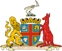
Coat of arms of the city of Adelaide, in Australia
Autor: User:Martyman, Licencja: CC-BY-SA-3.0
Locator Map for Adelaide-LGA-Mitcham-MJC.png
Drawn by me in Illustrator and released under the GFDL


