City of Moonee Valley
 | |
| Państwo | |
|---|---|
| Stan | |
| Burmistrz | Cr Paul Giuliano |
| Powierzchnia | 44 km² |
| Populacja • liczba ludności |
|
 | |
| Strona internetowa | |
| Portal | |
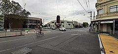
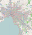
City of Moonee Valley – obszar samorządu lokalnego (ang. local government area), zlokalizowany w aglomeracji Melbourne. Powstała w 1994 roku z połączenia Essendon oraz części Keilor. Obszar ten zamieszkuje 107 090 osób (dane z 2006).
Dzielnice
- Aberfeldie
- Airport West
- Ascot Vale
- Avondale Heights
- Essendon
- Essendon North
- Essendon West
- Flemington
- Keilor East
- Moonee Ponds
- Niddrie
- North Melbourne
- Strathmore
- Strathmore Heights
- Travancore
Zobacz też
Media użyte na tej stronie
State flag and government ensign (internal waters only) of Victoria.
Autor: Sgroey, Licencja: CC BY-SA 4.0
City of Moonee Valley (local government area in Victoria, Australia)
Map of Melbourne's Local Government Areas, highlighting en:City of Moonee Valley
Autor: Squiresy92 including elements from Sodacan, Licencja: CC BY-SA 4.0
The Coat of Arms of Victoria.
Autor:
Autor: NordNordWest, Licencja: CC BY-SA 3.0 de
Location map of Victoria, Australia


