City of Port Phillip
| Państwo | |
|---|---|
| Stan | |
| Burmistrz | |
| Powierzchnia | 20.62 km² |
| Populacja • liczba ludności |
|
 | |
| Strona internetowa | |
| Portal | |
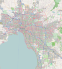
City of Port Phillip – obszar samorządu lokalnego (ang. local government area), położony na północnym brzegu australijskiej zatoki Port Phillip, wchodząca w skład aglomeracji Melbourne. Obszar ten zamieszkuje 85 096 osób (dane z roku 2006). Port Phillip został założony w 1994 roku, natomiast pierwsze wybory rady miasta odbyły się w 1996. Rada miasta zlokalizowana jest obecnie w St Kilda Town Hall i South Melbourne Town Hall.
Dzielnice
- Albert Park
- Balaclava
- Beacon Cove
- Elwood
- Garden City
- Middle Park
- Port Melbourne
- Ripponlea
- St Kilda
- St Kilda East
- St Kilda West
- Southbank
- South Melbourne
- Windsor
Burmistrzowie Port Phillip od 1996
| Burmistrz | Lata | |
|---|---|---|
| 1 | Liana Thompson | 1996–1997 |
| 2 | Christine Häag | 1997–1998 |
| 3 | Dick Gross | 1998–2000 |
| 4 | Julian Hill | 2000–2002 |
| 5 | Darren Ray | 2002–2003 |
| 6 | Liz Johnstone | 2003–2004 |
| 7 | Dick Gross | 2004 |
| 8 | Darren Ray | 2004–2005 |
| 9 | Janet Bolitho | 2005–2007 |
| 10 | Janet Cribbes | 2007–2008 |
| 11 | Frank O’Connor | obecnie |
Zobacz też
Media użyte na tej stronie
Autor: jjron, Licencja: GFDL 1.2
The St Kilda Town Hall (1890), one of the landmark buildings of St Kilda, Victoria, Australia.
State flag and government ensign (internal waters only) of Victoria.
Autor: Squiresy92 including elements from Sodacan, Licencja: CC BY-SA 4.0
The Coat of Arms of Victoria.
Map of Melbourne's Local Government Areas, highlighting City of Port Phillip
Autor:
Autor: NordNordWest, Licencja: CC BY-SA 3.0 de
Location map of Victoria, Australia


