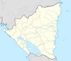
Ciudad Darío
| |||||
| Państwo | |||||
|---|---|---|---|---|---|
| Departament | |||||
| Powierzchnia | 735,0 km² | ||||
| Wysokość | 433 m n.p.m. | ||||
| Populacja • liczba ludności |
| ||||
| Kod pocztowy | 62800 | ||||
Ciudad Darío – miasto w Nikaragui, w departamencie Matagalpa.
Media użyte na tej stronie
Nicaragua location map.svg
Autor: Alexrk2, Licencja: CC BY-SA 3.0
Location map of Nicaragua with Departamentos, Equirectangular projection, N/S stretching 100 %. Geographic limits of the map:
Autor: Alexrk2, Licencja: CC BY-SA 3.0
Location map of Nicaragua with Departamentos, Equirectangular projection, N/S stretching 100 %. Geographic limits of the map:


