Ciudad Obregón
 Ulica Sonora w centrum miasta | |||
| |||
| Państwo | |||
|---|---|---|---|
| Stan | |||
| Burmistrz | Rogelio Diaz Brown | ||
| Wysokość | 40 m n.p.m. | ||
| Populacja (2005) • liczba ludności |
| ||
| Nr kierunkowy | 644 | ||
| Kod pocztowy | 85000 - 85059 | ||
| Tablice rejestracyjne | 26 | ||
| Strona internetowa | |||
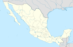
Ciudad Obregón – miasto w północno-zachodnim Meksyku, w stanie Sonora, w delcie rzeki Yaqui. Jest drugim pod względem liczebności mieszkańców miastem w tym stanie.
W mieście rozwinął się przemysł spożywczy oraz chemiczny[2].
Współpraca
Przypisy
- ↑ Instituto Nacional de Estadística, Geografía e Informática. Principales resultados por localidad 2005 (ITER).
- ↑ Ciudad Obregón, [w:] Encyklopedia PWN [online] [dostęp 2021-06-18].
- ↑ "Tucson Sister Cities"
Media użyte na tej stronie
The flag of Navassa Island is simply the United States flag. It does not have a "local" flag or "unofficial" flag; it is an uninhabited island. The version with a profile view was based on Flags of the World and as a fictional design has no status warranting a place on any Wiki. It was made up by a random person with no connection to the island, it has never flown on the island, and it has never received any sort of recognition or validation by any authority. The person quoted on that page has no authority to bestow a flag, "unofficial" or otherwise, on the island.
Flag of Sonora
Sonora street, Ciudad Obregón downtown
Autor: Sonorense434, Licencja: CC BY-SA 4.0
Escudo del municipio sonorense.


