Civic Arena (Pittsburgh)
 Obiekt w 2007 roku | |
| Przydomek: The Igloo The House That Lemieux Built | |
| Państwo | |
|---|---|
| Miejscowość | |
| Adres | 66 Mario Lemieux Place, Pittsburgh 15219-3504 |
| Lata budowy | 1958–1961 |
| Otwarta | 17 września 1961 |
| Zamknięta | 26 czerwca 2010 |
| Zburzona | 26 września 2011 – 31 marca 2012 |
| Architekt | Mitchell & Ritchey Architects |
| Właściciel | Sports & Exhibition Authority of Pittsburgh and Allegheny County |
| Operator | SMG |
| Liczba miejsc | |
| Siedzących (w sumie) | 17 537 |
| 40°26′30″N 79°59′24″W/40,441667 -79,990000 | |
Mellon Arena (lub Pittsburgh Civic Arena) – nieistniejąca hala sportowa znajdująca się w Pittsburghu w Stanach Zjednoczonych. Obiekt zburzono w 2012 roku.
Użytkownicy
- Pittsburgh Penguins (NHL)
- Pittsburgh Hornets (AHL)
- Pittsburgh Spirit (MISL)
- Pittsburgh CrosseFire (NLL)
- Pittsburgh Gladiators (AFL)
- Pittsburgh Phantoms (RHI)
- Pittsburgh Bulls (MILL)
- Pittsburgh Stingers (CISL)
- Pittsburgh Pipers/Condors (ABA)
- Pittsburgh Rens (ABL)
- Pittsburgh Xplosion (CBA)
Informacje
- adres: 66 Mario Lemieux Place, Pittsburgh, Pennsylvania 15219
- rozpoczęcie prac budowlanych: 12 marca 1957
- otwarcie: 19 września 1961
- koszt budowy: 22 miliony USD
- architekt: Mitchell and Ritchey
- pojemność:
- hokej i koszykówka: 17 537 miejsc
- football: 15 924 miejsc
- łyżwiarstwo figurowe: 16 882 miejsc
Koncerty
- 28 maja 1985: Madonna (The Virgin Tour) – widownia: 15 600 (100%)[1]
Przypisy
- ↑ Virgin Tour – Mad-Eyes – Madonna tour schedule, setlist, US tour. [dostęp: 2012-02-15]
Media użyte na tej stronie
Autor: Uwe Dedering, Licencja: CC BY-SA 3.0
Location map of the USA (without Hawaii and Alaska).
EquiDistantConicProjection:
Central parallel:
* N: 37.0° N
Central meridian:
* E: 96.0° W
Standard parallels:
* 1: 32.0° N
* 2: 42.0° N
Made with Natural Earth. Free vector and raster map data @ naturalearthdata.com.
Formulas for x and y:
x = 50.0 + 124.03149777329222 * ((1.9694462586094064-({{{2}}}* pi / 180))
      * sin(0.6010514667026994 * ({{{3}}} + 96) * pi / 180))
y = 50.0 + 1.6155950752393982 * 124.03149777329222 * 0.02613325650382181
      - 1.6155950752393982  * 124.03149777329222 *
     (1.3236744353715044  - (1.9694462586094064-({{{2}}}* pi / 180))
      * cos(0.6010514667026994 * ({{{3}}} + 96) * pi / 180))
The flag of Navassa Island is simply the United States flag. It does not have a "local" flag or "unofficial" flag; it is an uninhabited island. The version with a profile view was based on Flags of the World and as a fictional design has no status warranting a place on any Wiki. It was made up by a random person with no connection to the island, it has never flown on the island, and it has never received any sort of recognition or validation by any authority. The person quoted on that page has no authority to bestow a flag, "unofficial" or otherwise, on the island.
Autor: unknown, Licencja:
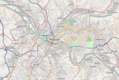
A map of the city of Pittsburgh and its surrounding areas
Autor: Alexrk2, Licencja: CC BY 3.0
Location map of Pennsylvania, USA


