Cléder
| gmina | |||
 | |||
| |||
| Państwo | |||
|---|---|---|---|
| Region | |||
| Departament | |||
| Okręg | |||
| Kod INSEE | 29030 | ||
| Powierzchnia | 37,26 km² | ||
| Populacja (1990) • liczba ludności |
| ||
| • gęstość | 102 os./km² | ||
| Kod pocztowy | 29233 | ||
| Portal | |||
Cléder (bret. Kleder) – miejscowość i gmina we Francji, w regionie Bretania, w departamencie Finistère.
Według danych na rok 1990 gminę zamieszkiwało 3801 osób, a gęstość zaludnienia wynosiła 102 osoby/km² (wśród 1269 gmin Bretanii Cléder plasuje się na 124. miejscu pod względem liczby ludności, natomiast pod względem powierzchni na miejscu 171.).
Bibliografia
- Francuski urząd statystyczny. (fr.).
Media użyte na tej stronie
Autor: Eric Gaba (Sting - fr:Sting), Licencja: CC BY-SA 3.0
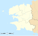
Blank administrative map of the department of Finistère, France, for geo-location purpose, with distinct boundaries for departments and arrondissements.
Autor: Superbenjamin, Licencja: CC BY-SA 4.0
Blank administrative map of France for geo-location purpose, with regions and departements distinguished. Approximate scale : 1:3,000,000
Autor: Eric Gaba (Sting - fr:Sting), Licencja: CC BY-SA 3.0
Blank administrative map of the region of Bretagne, France, for geo-location purpose, with distinct boundaries for regions, departments and arrondissements.
Autor: charles de kermenguy, Licencja: CC BY-SA 3.0
This building is inscrit au titre des monuments historiques de la France. It is indexed in the base Mérimée, a database of architectural heritage maintained by the French Ministry of Culture, under the reference PA00089875
Autor: Tretinville, Licencja: CC BY-SA 3.0
De gueules au château de deux tours et de deux cheminées d'or, ouvert et ajouré du champ, un dragon de sable issant de son porche, accompagné en chef de trois artichauts d'argent rangés en fasce et en pointe d'une moucheture d'hermine du même.


