Clearwell
(c) Pauline Eccles, CC BY-SA 2.0 | |
| Państwo | |
|---|---|
| Kraj | |
| Hrabstwo | |
| Dystrykt | |
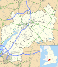
Położenie na mapie Gloucestershire Contains Ordnance Survey data © Crown copyright and database right, CC BY-SA 3.0 | |
Położenie na mapie Wielkiej Brytanii (c) Karte: NordNordWest, Lizenz: Creative Commons by-sa-3.0 de | |
| Portal | |
Clearwell – wieś w Anglii, w hrabstwie Gloucestershire, w dystrykcie Forest of Dean. Leży 29 km na południowy zachód od miasta Gloucester i 175 km na zachód od Londynu[1].
Przypisy
- ↑ Clearwell na mapie (ang.). getamap.ordnancesurvey.co.uk. [dostęp 2010-11-27].
Media użyte na tej stronie
(c) Karte: NordNordWest, Lizenz: Creative Commons by-sa-3.0 de
Location map of the United Kingdom
Flag of England. Saint George's cross (a red cross on a white background), used as the Flag of England, the Italian city of Genoa and various other places.
Contains Ordnance Survey data © Crown copyright and database right, CC BY-SA 3.0
Map of Gloucestershire, UK with the following information shown:
- Administrative borders
- Coastline, lakes and rivers
- Roads and railways
- Urban areas
Equirectangular map projection on WGS 84 datum, with N/S stretched 160%
Geographic limits:
- West: 2.70W
- East: 1.60W
- North: 52.16N
- South: 51.36N
(c) Pauline Eccles, CC BY-SA 2.0
The village of Clearwell Situated on a narrow valley floor with steep sides, south of the old market town of Coleford is Clearwell, once known as Wellington, meaning the place of the spring. The spring can be found behind the Wyndham Arms and was once important in the tanning and nail making industries. In the 13th century the name of the village was changed to Clearwell, meaning the spring amongst the clovers. In the centre of the village is a tall 14th century cross; the shaft and cross were replaced when the church was built in 1866 in its new location.


