Cmentarz Mitrofanijewski
| ||
 | ||
| Państwo | ||
| Data otwarcia | 1831 | |
| Data likwidacji | 1944 | |
| 59°53′36,03″N 30°18′19,50″E/59,893342 30,305417 | ||
Cmentarz Mitrofanijewski (ros. Митрофаниевское кладбище, Mitrofanijewskoje kładbiszcze) – stara nekropolia w Petersburgu.
Pochowani
Linki zewnętrzne
Media użyte na tej stronie
Autor: Uwe Dedering, Licencja: CC BY-SA 3.0
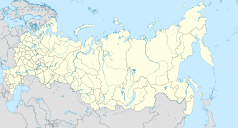
Location map of Russia.
EquiDistantConicProjection : Central parallel :
* N: 54.0° N
Central meridian :
* E: 100.0° E
Standard parallels:
* 1: 49.0° N
* 2: 59.0° N
Made with Natural Earth. Free vector and raster map data @ naturalearthdata.com.
Because the southern Kuril islands are claimed by Russia and Japan, they are shown as disputed. For more information about this see: en:Kuril Islands dispute. These islands are since 1945 under the jurisdiction of the Russian Federation.
Symbol miejsca kultu do legendy mapy
Церковь во имя Святителя Митрофана Воронежского на Митрофаниевском кладбище в Санкт-Петербурге, архитектор К.А. Тон, построена в 1839-1847 гг., снесена в 1929 г.
Autor: Autor nie został podany w rozpoznawalny automatycznie sposób. Założono, że to Obersachse (w oparciu o szablon praw autorskich)., Licencja: CC-BY-SA-3.0
Object: Saint Petersburg
- Description: Saint Petersburg locator map
- Author: Obersachse
- Created: 2007-05-16
- Source: image:Spb all districts 2005 abc rus.svg, drawn by Panther using Corel Draw


