Cone
 | |
| Państwo | |
|---|---|
| Terytorium zależne | |
| Położenie | Sermersooq |
| Pasmo | |
| Wysokość | 3669 m n.p.m. |
Cone (z ang. stożek) − szczyt w Górach Watkinsa na wschodzie Grenlandii. Wznosi się na 3669 m n.p.m., dzięki czemu plasuje się na 3 miejscu w tych górach pod względem wysokości. Razem z Górą Gunnbjørna i Dome tworzy najwyższe pasmo Gór Watkinsa. Ma postać nunataku. Nazwa Cone pochodzi od stożkowatego kształtu góry.
Bibliografia
- Informacje o szczycie na Peakware.com. peakware.com. [zarchiwizowane z tego adresu (2013-05-12)].
Media użyte na tej stronie
Black up-pointing triangle ▲, U+25B2 from Unicode-Block Geometric Shapes (25A0–25FF)
Autor: Uwe Dedering, Licencja: CC BY-SA 3.0
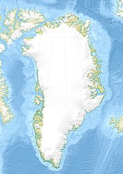
Relief location map of Greenland.
- Projection: EquiDistantConicProjection.
- Area of interest:
- N: 85.0° N
- S: 59.0° N
- W: -75.0° E
- E: -10.0° E
- Projection center:
- NS: 72.0° N
- WE: -42.5° E
- Standard parallels:
- 1: 64.0° N
- 2: 80.0° N
- GMT projection: -JD-42.5/72/64/80/20c
- GMT region: -R-60.16/57.61/24.5/79.91r
- GMT region for grdcut: -R-120.24/57.61/24.5/85.78r
- Relief: SRTM30plus.
- Made with Natural Earth. Free vector and raster map data @ naturalearthdata.com.
Autor: Paolo Gardino, Licencja: CC BY-SA 3.0
The Cone the third highest mountain in Greenland


