Contagem
| |||||
| Państwo | |||||
|---|---|---|---|---|---|
| Stan | |||||
| Powierzchnia | 194,6 km² | ||||
| Populacja (2009) • liczba ludności |
| ||||
| Nr kierunkowy | 31 | ||||
| Kod pocztowy | 32000-000 | ||||
| Strona internetowa | |||||
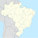
Contagem − miasto we wschodniej Brazylii, w stanie Minas Gerais, w regionie metropolitalnym Belo Horizonte.
Około 591,5 tys. mieszkańców.
W mieście rozwinął się przemysł spożywczy, materiałów budowlanych, szklarski, elektromaszynowy oraz hutniczy[2].
Linki zewnętrzne
Przypisy
- ↑ Estimativas da populaçao para 1o de julho de 2009
- ↑ Contagem, [w:] Encyklopedia PWN [online] [dostęp 2021-06-18].
Media użyte na tej stronie
Autor: Autor nie został podany w rozpoznawalny automatycznie sposób. Założono, że to Mateuszica~commonswiki (w oparciu o szablon praw autorskich)., Licencja: CC-BY-SA-3.0
- Ilustração feita por Mateus Zica Machado Brandão em 26 de maio de 2006.
-- *Ilustração baseada no brasão de 1963. Foram adicionados novos detalhes tridimensionais nos tijolos da torre do Itaú.
- Ilustration created by Mateus Zica Machado Brandão in May 26 2006.
-- *Ilustration based in Coat of arms from 1963. Added New trindimensional details in the bricks in the itau tower.
Livre para usar em qualquer lugar.
Bandeira de Contagem.Autor:
- MinasGerais_MesoMicroMunicip.svg: Raphael Lorenzeto de Abreu
- derivative work: Milenioscuro (talk)
Location map of Minas Gerais state.
Equirectangular projection, N/S stretching 106 %. Geographic limits of the map:
- N: 13.93° S
- S: 23.67° S
- W: 51.80° W
- E: 39.80° W
Autor: Mateuszica, Licencja: CC-BY-SA-3.0
View over central Contagem.
- (del) (cur) 23:35, 13 September 2005 . . Mateuszica (Talk) . . 1894x400 (127,035 bytes) (picture i took myself it is the center of contagem)


