Corcelles (Ain)
| miejscowość | |||
 | |||
| |||
| Państwo | |||
|---|---|---|---|
| Region | |||
| Departament | |||
| Okręg | |||
| Kanton | Brénod | ||
| Kod INSEE | 01119 | ||
| Mer | Alain Balland (2001-2020) | ||
| Powierzchnia | 14,16 km² | ||
| Wysokość | 780-1081 m n.p.m. | ||
| Populacja (2013) • liczba ludności |
| ||
| Kod pocztowy | 01110 | ||
| Portal | |||
Corcelles – miejscowość i dawna gmina we Francji, w regionie Owernia-Rodan-Alpy, w departamencie Ain. W dniu 1 stycznia 2016 roku z połączenia dwóch ówczesnych gmin – Champdor oraz Corcelles – powstała nowa gmina Champdor-Corcelles[1]. W 2013 roku populacja Corcelles wynosiła 238 mieszkańców[2].
Przypisy
- ↑ ARRETE portant création de la commune nouvelle de Champdor-Corcelles. ain.gouv.fr. [dostęp 2016-11-14]. (fr.).
- ↑ Populations légales 2013 - 01119-Corcelles. INSEE. [dostęp 2016-11-14]. (fr.).
Media użyte na tej stronie
Autor: Flappiefh, Licencja: CC BY-SA 4.0
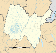
Blank administrative map of the department of Ain, France, for geo-location purpose.
Autor: Superbenjamin, Licencja: CC BY-SA 4.0
Blank administrative map of France for geo-location purpose, with regions and departements distinguished. Approximate scale : 1:3,000,000
Autor: Flappiefh, Licencja: CC BY-SA 4.0
Carte administrative vierge de la région Auvergne-Rhône-Alpes, France, destinée à la géolocalisation.
Autor: Chabe01, Licencja: CC BY-SA 4.0
Église Saint-Martin de Corcelles, Champdor-Corcelles.


