Corinto
| ||
 | ||
| Państwo | ||
| Departament | Chinandega | |
| Wysokość | 1 m n.p.m. | |
| Populacja (2005) • liczba ludności | 22 000 | |
| Kod pocztowy | 26400 | |
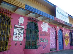
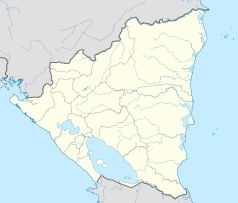
Corinto – miasto w północno-zachodniej Nikaragui, w departamencie Chinandega zamieszkany przez 22 tys. mieszkańców (2005). Położone nad Oceanem Spokojnym, kilkanaście kilometrów na południe od miasta Chinandega, stanowi główny port morski kraju.
Miasto zostało założone w 1863 roku.
Corinto posiada bezpośrednie połączenie kolejowe z gospodarczym i politycznym centrum kraju. Linia kolejowa o długości 348 km bierze swój początek na wybrzeżu pacyficznym i łączy Corinto z głównym ośrodkami miejskimi kraju: Chinandega, León, Managua, Masaya i Granada. Port morski w Corinto może obsługiwać różnorodne towary, posiada m.in. terminal kontenerowy. Jest on największym środkowoamerykańskim portem na wybrzeżu pacyficznym.
Miasta partnerskie
Linki zewnętrzne
Media użyte na tej stronie
The flag of Navassa Island is simply the United States flag. It does not have a "local" flag or "unofficial" flag; it is an uninhabited island. The version with a profile view was based on Flags of the World and as a fictional design has no status warranting a place on any Wiki. It was made up by a random person with no connection to the island, it has never flown on the island, and it has never received any sort of recognition or validation by any authority. The person quoted on that page has no authority to bestow a flag, "unofficial" or otherwise, on the island.
Autor: Alexrk2, Licencja: CC BY-SA 3.0
Location map of Nicaragua with Departamentos, Equirectangular projection, N/S stretching 100 %. Geographic limits of the map:


