Cradle Mountain
| ||
 Panorama Cradle Mountain z zachodu. | ||
| Państwo | ||
| Stan | ||
| Położenie | Tasmania | |
| Wysokość | 1 545 m n.p.m. | |
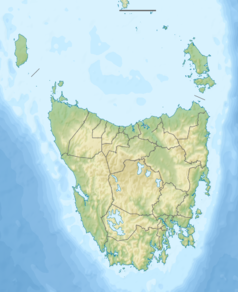
Cradle Mountain - góra położona na Tasmanii o wysokości 1 545 m n.p.m., stanowi charakterystyczny element Parku Narodowego Cradle Mountain-Lake St Clair. Cradle Mountain zbudowana jest z diabazu.
W skład góry wchodzą cztery szczyty: Cradle Mountain (1 545 m n.p.m.), Smithies Peak (1 545 m n.p.m.), Weindorfers Tower (1 459 m n.p.m.) i Little Horn (1 355 m n.p.m.).
Linki zewnętrzne
Media użyte na tej stronie
Autor: , Licencja: CC BY-SA 3.0
Relief map of Australia, including the borders of the states of the Commonwealth of Australia
Black up-pointing triangle ▲, U+25B2 from Unicode-Block Geometric Shapes (25A0–25FF)
Autor: Bjørn Christian Tørrissen, Licencja: CC BY-SA 3.0
Cradle Mountain as seen from the west. You can see the path leading to the top, going up from Kitchen Hut in the centre of the photo. To the far right is another distinct mountain, Barn Bluff.


