Craighouse
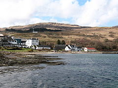
(c) Gordon Hatton, CC BY-SA 2.0 | |
| Państwo | |
|---|---|
| Kraj | |
| Hrabstwo | |
| Populacja (1971) • liczba ludności |
|
Położenie na mapie Argyll and Bute Contains Ordnance Survey data © Crown copyright and database right, CC BY-SA 3.0 | |
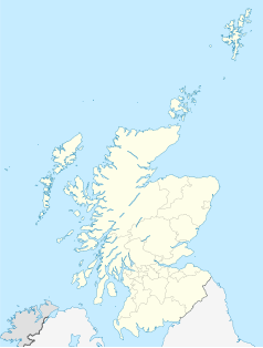
Położenie na mapie Wielkiej Brytanii (c) Karte: NordNordWest, Lizenz: Creative Commons by-sa-3.0 de | |
Położenie na mapie Szkocji | |
| 55°50′N 5°56′W/55,833333 -5,933333 | |
| Portal | |
Craighouse (gaelicki: Taigh na Creige)[1] – stolica[2] i największa miejscowość na wyspie Jura, w Szkocji, w hrabstwie Argyll and Bute, w civil parish Jura. Leży 10 km od Port Askaig. W 1971 miejscowość liczyła 113 mieszkańców[3]. Posiada połączenie promowe z Tayvallich.[4]
Przypisy
- ↑ Craighouse. Ainmean-Àite na h-Alba. [dostęp 2022-07-18]. (ang.).
- ↑ Isle of Jura. The Internet Guide to Scotland. [dostęp 2020-05-18]. (ang.).
- ↑ Classification and statistics. Gazetteer for Scotland. [dostęp 2020-05-14]. (ang.).
- ↑ Craighouse to Tayvallich. CalMac Ferries. [dostęp 2020-05-14]. [zarchiwizowane z tego adresu (2017-01-02)]. (ang.).
Media użyte na tej stronie
(c) Karte: NordNordWest, Lizenz: Creative Commons by-sa-3.0 de
Location map of the United Kingdom
(c) Eric Gaba, NordNordWest, CC BY-SA 3.0
Location map of Scotland, United Kingdom
(c) Gordon Hatton, CC BY-SA 2.0
Original description:
Craighouse - village centre
Most of the main buildings in the village can be seen in this shot, including [L-R] The Jura Hotel, the distillery, the shop and the village hall.Contains Ordnance Survey data © Crown copyright and database right, CC BY-SA 3.0
Blank map of Argyll and Bute, UK with the following information shown:
- Administrative borders
- Coastline, lakes and rivers
- Roads and railways
- Urban areas
Equirectangular map projection on WGS 84 datum, with N/S stretched 175%
Geographic limits:
- West: 7.2W
- East: 4.5W
- North: 56.8N
- South: 55.2N


