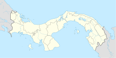
Cristóbal (Panama)
Media użyte na tej stronie
Cristobal 1104 Terminal St (Aug 1999).jpg
(c) Cz ferenc at the English Wikipedia, CC-BY-SA-3.0
Almost unchanged for a century, the Royal Mail Lines bldg (#1104) in the heart of Cristobal's "Steamship Row."
(c) Cz ferenc at the English Wikipedia, CC-BY-SA-3.0
Almost unchanged for a century, the Royal Mail Lines bldg (#1104) in the heart of Cristobal's "Steamship Row."
Panama location map.svg
Autor: Alexrk, Licencja: CC BY-SA 3.0
Location map of Panama
Autor: Alexrk, Licencja: CC BY-SA 3.0
Location map of Panama
Equirectangular projection. Geographic limits of the map:
- N: 10.28° N
- S: 6.79° N
- W: 83.56° W
- O: 76.64° W


