Cullman-Heyman Tennis Center
| ||
| Cullman-Heyman Tennis Center | ||
| Państwo | ||
| Stan | ||
| Miejscowość | New Haven | |
| Data otwarcia | 1991 | |
| Pojemność stadionu | 15 000 (główny stadion) | |
| Nawierzchnia boiska | Twarda | |
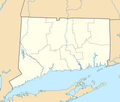
Cullman-Heyman Tennis Center lub Connecticut Tennis Center at Yale – kompleks tenisowy w New Haven w stanie Connecticut.
Obiekt oddany do użytkowania został w 1991 roku. Składa się z 22 kortów twardych typu Deco Turf II i 8 kortów w hali. Kort centralny, nazwany Connecticut Tennis Center, mieści łącznie 15 000 widzów i jest największym stadionem tenisowym w Stanach Zjednoczonych po Arthur Ashe Stadium i głównym korcie Indian Wells Tennis Garden[1]. W 2008 roku obiekt przeszedł renowację[2].
Od 1998 roku w kompleksie organizowany jest tenisowy turniej kobiecy Connecticut Open rangi WTA Premier Series. W latach 2005–2010 rywalizowali również mężczyźni, a turniej nosił nazwę Pilot Pen Tennis.
Przypisy
- ↑ Cullman-Heyman Tennis Center (ang.). sportsandrecreation.yale.edu. [dostęp 2013-04-23].
- ↑ Cullman-Heyman Tennis Center Capitals, Yale University (ang.). bloomerstudio.com. [dostęp 2013-04-23].
Media użyte na tej stronie
Autor: Alexrk2, Licencja: CC BY 3.0
Ta mapa została stworzona za pomocą GeoTools.
Autor: Uwe Dedering, Licencja: CC BY-SA 3.0
Location map of the USA (without Hawaii and Alaska).
EquiDistantConicProjection:
Central parallel:
* N: 37.0° N
Central meridian:
* E: 96.0° W
Standard parallels:
* 1: 32.0° N
* 2: 42.0° N
Made with Natural Earth. Free vector and raster map data @ naturalearthdata.com.
Formulas for x and y:
x = 50.0 + 124.03149777329222 * ((1.9694462586094064-({{{2}}}* pi / 180))
      * sin(0.6010514667026994 * ({{{3}}} + 96) * pi / 180))
y = 50.0 + 1.6155950752393982 * 124.03149777329222 * 0.02613325650382181
      - 1.6155950752393982  * 124.03149777329222 *
     (1.3236744353715044  - (1.9694462586094064-({{{2}}}* pi / 180))
      * cos(0.6010514667026994 * ({{{3}}} + 96) * pi / 180))
The flag of Navassa Island is simply the United States flag. It does not have a "local" flag or "unofficial" flag; it is an uninhabited island. The version with a profile view was based on Flags of the World and as a fictional design has no status warranting a place on any Wiki. It was made up by a random person with no connection to the island, it has never flown on the island, and it has never received any sort of recognition or validation by any authority. The person quoted on that page has no authority to bestow a flag, "unofficial" or otherwise, on the island.
Autor:
- Gfi-set01-stadium.png: gfi
- derivative work: Frédéric (talk)
icone pour terrain de sport


