Dabakala
| Państwo | |
|---|---|
| Dystrykt | |
| Wysokość | 254 m n.p.m. |
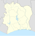
Położenie na mapie Wybrzeża Kości Słoniowej | |
Dabakala – miasto w Wybrzeżu Kości Słoniowej, w dystrykcie Vallée du Bandama, w regionie Hambol, w departamencie Dabakala.
Media użyte na tej stronie
Flag of the Ivory Coast, written by Jon Harald Søby, modified by Zscout370. The colors match to what is reported at http://fotw.vexillum.com/flags/ci.html.
(c) Uwe Dedering z niemieckiej Wikipedii, CC BY-SA 3.0
Location map of Côte d'Ivoire Equirectangular projection.
Strechted by 101%. Geographic limits of the map:
- N: 11° N
- S: 4° N
- W: 9° W
- E: 2° W


