Darrang
| Dystrykt | |
 | |
| Państwo | |
|---|---|
| Stan | Asam |
| Siedziba | Mangaldai |
| Powierzchnia | 1 420.51 km² |
| Populacja (2001) • liczba ludności |
|
Położenie na mapie | |
Darrang (hindi दारांग जिला) – jeden z 27 dystryktów administracyjnych w stanie Asam w Indiach[1], położony w północno-zachodniej części stanu. Stolicą dystryktu jest miasto Mangaldai. Dystrykt graniczy z dystryktem Kamrup od wschodu i częściowo od południa. Następnie granicę przebiega wzdłuż rzeki Brahmaputra, wspólnie z dystryktem Marigaon. Od północy dystrykt graniczy z państwem Bhutan oraz częściowo z dystryktem West Kameng w stanie Arunachal Pradesh. Od zachodu sąsiadem jest dystrykt Sonitpur. Rejon ma obszar 1 420.51 km²[2], a populacja wyniosła 759 712 osób, w 2001 roku.
Demografia
Wśród mieszkańców stanu Darrang większość stanowią wyznawcy hinduizmu 868,532 (57,74%). Drugą co do liczebności grupę, stanowią muzułmanie 534,658 (35,54) a w dalszej kolejności chrześcijanie 97,306 (1,75%)[3]. Większość mieszkańców dystryktu (55,15%) potrafi czytać i pisać. Wśród mieszkańców około 85% jest związana z rolnictwem i pochodnymi.
Zobacz też
Linki zewnętrzne
Przypisy
- ↑ Dystrykty stanu Asam. [dostęp 2010-02-28]. [zarchiwizowane z tego adresu (2014-01-21)].
- ↑ Profil na stronie dystryktu
- ↑ Demographic Features of the District. [dostęp 2010-02-28]. [zarchiwizowane z tego adresu (2009-03-07)].
Media użyte na tej stronie
The Flag of India. The colours are saffron, white and green. The navy blue wheel in the center of the flag has a diameter approximately the width of the white band and is called Ashoka's Dharma Chakra, with 24 spokes (after Ashoka, the Great). Each spoke depicts one hour of the day, portraying the prevalence of righteousness all 24 hours of it.
Autor: Map made by me, Nichalp, Licencja: CC-BY-SA-3.0
Note: The Indian state of w:Jammu and Kashmir is claimed by w:India, w:Pakistan and the w:People's Republic of China. This map depicts the boundaries of the state as it was in 1947. Areas administered by India is coloured as per the rest of the states, and the area administered by Pakistan and China are coloured in a neutral colour. See the map of Jammu and Kashmir. The Indian state of w:Arunachal Pradesh is claimed by China as a part of w:South Tibet. The claimed region is depicted in a pale shade of pink. See the map of Arunachal Pradesh. The Indian territorial waters extend to a distance of twelve nautical miles.
Autor: Sougata Sinha Roy, Licencja: CC BY 3.0
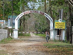
Manas National Park, Assam- rich flora and fauna...
Autor: Own work based on User:Planemad, Licencja: CC BY 3.0
Map of Darrang district of Assam


