Darwin
 | |||
| |||
| Państwo | |||
|---|---|---|---|
| Terytorium | |||
| Zarządzający | Kon Vatskalis↗ | ||
| Powierzchnia | 3164[1] km² | ||
| Populacja (06.2020) • liczba ludności • gęstość |
| ||
| Nr kierunkowy | 0879 | ||
| Kod pocztowy | 0800 | ||
| Strona internetowa | |||
| Portal | |||
Darwin (wym. [ˈdɑrwɨn]) – miasto w Australii, leżące w środkowej części północnego wybrzeża Australii, stolica Terytorium Północnego. Położone jest nad cieśniną Clarence (Morze Timor, Ocean Indyjski). Miasto zamieszkane jest przez 147 231 osób[2]. W mieście działa polski konsulat honorowy. Jego współrzędne geograficzne to 12° 25′ S 130° 48′ E. Miasto leży w strefie tropikalnego klimatu sawann (klasyfikacja Köppena – Aw)[3].
Miasto zostało nazwane na cześć Karola Darwina.
Założone zostało w 1869 jako stacja telegraficzna. W czasie II wojny światowej stanowiło bazę zaopatrzeniową (1942 silne bombardowania japońskie). Prawa miejskie otrzymało w 1969. W 1974 roku miasto zostało doszczętnie zniszczone przez cyklon Tracy, w czasie którego zginęło 71 osób, a dwadzieścia tysięcy ludzi straciło dach nad głową. Odbudowano je dopiero w latach osiemdziesiątych XX wieku.
Obecnie Darwin to najważniejszy port na północnym wybrzeżu Australii. Kończy się tutaj transkontynentalna szosa (Stuart Highway) z Australii Południowej oraz wybudowana w 2004 roku linia kolejowa zwana The Ghan. W mieści istnieje stacja kolejowa Darwin oraz port lotniczy Darwin. Przy lotnisku działa wojskowa baza lotnicza RAAF Base Darwin. W mieście rozwinął się przemysł mięsny oraz lotniczy[4].
Duże zróżnicowanie etniczne mieszkańców, w tym również niewielka Polonia.
Klimat
Darwin leży w strefie klimatu tropikalnego, z całorocznym okresem z letnimi temperaturami.
| Miesiąc | Sty | Lut | Mar | Kwi | Maj | Cze | Lip | Sie | Wrz | Paź | Lis | Gru | Roczna |
|---|---|---|---|---|---|---|---|---|---|---|---|---|---|
| Średnie temperatury w dzień [°C] | 31.8 | 31.5 | 32.1 | 32.9 | 32.3 | 30.8 | 30.8 | 31.6 | 32.8 | 33.5 | 33.5 | 32.7 | 32,2 |
| Średnie dobowe temperatury [°C] | 28.4 | 28.2 | 28.4 | 28.6 | 27.4 | 25.5 | 25.1 | 26.0 | 28.0 | 29.3 | 29.6 | 29.2 | 29,2 |
| Średnie temperatury w nocy [°C] | 25.0 | 24.9 | 24.7 | 24.3 | 22.5 | 20.1 | 19.4 | 20.4 | 23.2 | 25.0 | 25.6 | 25.6 | 23,4 |
| Opady [mm] | 466 | 373 | 335 | 108 | 24.7 | 2.3 | 1.2 | 5.8 | 17.4 | 65.4 | 137 | 276 | 1811 |
| Średnia liczba dni z opadami | 22.3 | 21.1 | 19.6 | 9.8 | 2.3 | 0.7 | 0.4 | 0.7 | 2.9 | 6.7 | 12.5 | 16.9 | 116 |
| Średnie usłonecznienie (w godzinach) | 180 | 162 | 220 | 264 | 304 | 300 | 316 | 319 | 294 | 298 | 252 | 208 | 3111 |
| Źródło: Bureau of Meteorology[5] | |||||||||||||
| Sty | Lut | Mar | Kwi | Maj | Cze | Lip | Sie | Wrz | Paź | Lis | Gru | Rok |
|---|---|---|---|---|---|---|---|---|---|---|---|---|
| 30,6 | 30,2 | 30,2 | 30,2 | 29,1 | 26,7 | 25,8 | 26,4 | 27,7 | 29,5 | 30,9 | 31,5 | 29 |
Zobacz też
- podział terytorialny Darwin
- City of Darwin
- Hrabstwo Litchfield
- Diecezja Darwin
- Kategoria:Ludzie związani z Darwin
Przypisy
- ↑ Australian Bureau of Statistics: 2011 Census Community Profiles: Greater Darwin. ABS Census.
- ↑ a b Australian Bureau of Statistics: Regional population. Australian Bureau of Statistics.
- ↑ Michael Pidwirny: Tropical Moist Climates - A Climate Type. The Encyclopedia of Earth. [dostęp 2014-11-22]. [zarchiwizowane z tego adresu (2016-03-04)]. (ang.).
- ↑ Darwin, [w:] Encyklopedia PWN [online] [dostęp 2021-06-19].
- ↑ Bureau of Meteorology: Climate statistics for Australian locations. Darwin Airport.
- ↑ Darwin average sea temperature – seatemperature.org.
Linki zewnętrzne
- Oficjalna strona portu Darwin
- Oficjalna strona władz miasta. darcity.nt.gov.au. [zarchiwizowane z tego adresu (2008-09-18)].
Media użyte na tej stronie
Autor: SaluteVII, Licencja: CC BY-SA 4.0
This is the Coat of Arms of Darwin, emblazoned by Jack Ryan Morris
Autor: Tentotwo, Licencja: CC BY-SA 3.0
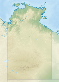
Relief location map of the Northern Territory, Australia Equidistant cylindrical projection, latitude of true scale 17.75° S (equivalent to equirectangular projection with N/S stretching 105 %). Geographic limits of the map:
- N: 10.6° S
- S: 26.5° S
- W: 127.5° E
- E: 139.5° E
Autor: , Licencja: CC BY-SA 3.0
Relief map of Australia, including the borders of the states of the Commonwealth of Australia
Autor: Jeremy De Guzman, Licencja: CC BY 2.0
Darwin skyline
The flag of the Northern Territory (adopted on July 1, 1978 on the first day of self-government) was designed by the Australian artist Robert Ingpen, of Drysdale Victoria, after consultation with members of the community at the invitation of the Northern Territory Government. The flag incorporates the three official Territorian colours of black, white and ochre and is divided into two panels, black at the hoist side taking up one third the length of the flag while the remainder is equal to two third the length of the flag in ochre. The black panel display the five white stars that form the constellation of the Southern Cross, using the Victorian configuration of the Southern Cross with stars having between five to eight points. The flag also features the official Northern Territory floral emblem on the red ochre panel, a stylisation of the Sturt's Desert Rose, which uses seven petals encircling a seven-pointed black star of the federation in the centre. The seven petals symbolises the six Australian states plus the Northern Territory. The Northern Territory Flag was the first official flag that did not contain the Union Jack.


