Daytona Beach
 | |
| Państwo | |
|---|---|
| Stan | |
| Hrabstwo | |
| Data założenia | 1870[1] |
| Prawa miejskie | 1876[1] |
| Burmistrz | Derrick Henry |
| Powierzchnia | 168,2 km² |
| Wysokość | 4 m n.p.m. |
| Populacja (2006) • liczba ludności • gęstość |
|
| Nr kierunkowy | 386 |
| Kod pocztowy | 32114-32126, 32198 |
| Strona internetowa | |
| Portal | |
Daytona Beach – miasto w Stanach Zjednoczonych, w hrabstwie Volusia, w stanie Floryda, nad Oceanem Atlantyckim.
W 2006 roku miasto miało 64,4 tys. mieszkańców. Rocznie przyjeżdża tu 8 mln turystów.
Sport
W mieście co roku rozgrywany jest kobiecy turniej tenisowy[2], pod nazwą DME Sports Women's Pro Tennis Championship, z pulą nagród 25 000 $[3].
W Daytona Beach 28 stycznia 1989 roku zmarła Halina Konopacka – polska lekkoatletka.
Zobacz też
Miasta partnerskie
Przypisy
- ↑ a b Daytona Beach, [w:] Encyklopedia PWN [online] [dostęp 2021-06-20].
- ↑ Tennis – Womens Pro Circuit Tournament Daytona Beach [dostęp 2018-01-19] [zarchiwizowane z adresu 2015-04-09] (ang.).
- ↑ ITF Tennis – Pro Circuit – Tournaments List – 01 January 2015 – 31 January 2015. itftennis.com. [zarchiwizowane z tego adresu (2015-09-20)]. (ang.)
Media użyte na tej stronie
Autor: Uwe Dedering, Licencja: CC BY-SA 3.0
Location map of the USA (without Hawaii and Alaska).
EquiDistantConicProjection:
Central parallel:
* N: 37.0° N
Central meridian:
* E: 96.0° W
Standard parallels:
* 1: 32.0° N
* 2: 42.0° N
Made with Natural Earth. Free vector and raster map data @ naturalearthdata.com.
Formulas for x and y:
x = 50.0 + 124.03149777329222 * ((1.9694462586094064-({{{2}}}* pi / 180))
      * sin(0.6010514667026994 * ({{{3}}} + 96) * pi / 180))
y = 50.0 + 1.6155950752393982 * 124.03149777329222 * 0.02613325650382181
      - 1.6155950752393982  * 124.03149777329222 *
     (1.3236744353715044  - (1.9694462586094064-({{{2}}}* pi / 180))
      * cos(0.6010514667026994 * ({{{3}}} + 96) * pi / 180))
The flag of Navassa Island is simply the United States flag. It does not have a "local" flag or "unofficial" flag; it is an uninhabited island. The version with a profile view was based on Flags of the World and as a fictional design has no status warranting a place on any Wiki. It was made up by a random person with no connection to the island, it has never flown on the island, and it has never received any sort of recognition or validation by any authority. The person quoted on that page has no authority to bestow a flag, "unofficial" or otherwise, on the island.
Autor:
- DaytonaBeach_Collage.jpg: Gamweb
- derivative work: AndrewAvitus (talk)
Montage of Daytona Beach, Florida, photos for infobox. From top, left to right: Welcome sign when entering Daytona Beach; Daytona Beach Bandshell; Ocean Walk Shoppes; Daytona Beach Pier; Daytona International Speedway. (All individual photos taken by Gamweb).
Autor: Jake N., Licencja: CC BY 2.0
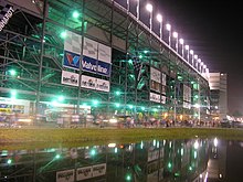
Exterior of the Main Entrance of the Daytona International Speedway at night, taken on 30 June, 2005.


