Diecezja Corpus Christi
| ||
 | ||
| Państwo | ||
| Siedziba | Corpus Christi P.O. Box 2620, Corpus Christi, TX 78403-2620; 620 Lipan Street, Corpus Christi, TX 78401 | |
| Data powołania | 23 marca 1912 | |
| Wyznanie | katolickie | |
| Kościół | rzymskokatolicki | |
| Metropolia | Galveston-Houston | |
| Katedra diecezjalna | Katedra Ciała Chrystusa w Corpus Christi | |
| Biskup diecezjalny | bp William Mulvey | |
| Biskup senior | bp Edmond Carmody bp René Gracida | |
| Dane statystyczne (2006) | ||
| Liczba wiernych • odsetek wiernych | 388 878 70% | |
| Liczba kapłanów • w tym diecezjalnych • w tym zakonnych | 146 114 32 | |
| Liczba osób zakonnych | 151 | |
| Liczba parafii | 68 | |
| Powierzchnia | 29 690 km² | |
| Strona internetowa | ||
Diecezja Corpus Christi (łac. Dioecesis Corporis Christi, ang. Diocese of Corpus Christi) jest diecezją Kościoła rzymskokatolickiego w metropolii Galveston-Houston w Stanach Zjednoczonych w południowej części stanu Teksas.
Historia
Diecezja została kanonicznie erygowana 23 marca 1912 roku przez papieża Piusa X. Wcześniej, od 28 sierpnia 1874 był to Wikariat apostolski Brownsville wyodrębniony z terenów ówczesnej diecezji Galveston. Pierwszym wikariuszem został kapłan diecezji Mobile Dominic Manucy (1823-1885). Diecezja kilkukrotnie traciła część terytoriów na rzecz nowo tworzonych jednostek administracyjnych (diecezje Brownsville, Victoria i Laredo).
Ordynariusze
- Dominic Manucy (1874-1884) - wikariusz apostolski
- Peter Verdaguer y Prat (1890-1911) - wikariusz apostolski
- Paul Joseph Nussbaum (1913-1920) - pierwszy ordynariusz
- Emmanuel Boleslaus Ledvina (1921-1949)
- Mariano Simon Garriga (1949-1965)
- Thomas Joseph Drury (1965-1983)
- René Gracida (1983-1997)
- Roberto González Nieves (1997-1999)
- Edmond Carmody (2000-2010)
- William Mulvey (od 2010)
Bibliografia
- Oficjalna strona internetowa diecezji Corpus Christi (ang.)
- Diecezja Corpus Christi w bazie catholic-hierarchy.org (ang.)
- Encyklopedia New Advent (ang.)
Media użyte na tej stronie
Autor: Uwe Dedering, Licencja: CC BY-SA 3.0
Location map of the USA (without Hawaii and Alaska).
EquiDistantConicProjection:
Central parallel:
* N: 37.0° N
Central meridian:
* E: 96.0° W
Standard parallels:
* 1: 32.0° N
* 2: 42.0° N
Made with Natural Earth. Free vector and raster map data @ naturalearthdata.com.
Formulas for x and y:
x = 50.0 + 124.03149777329222 * ((1.9694462586094064-({{{2}}}* pi / 180))
      * sin(0.6010514667026994 * ({{{3}}} + 96) * pi / 180))
y = 50.0 + 1.6155950752393982 * 124.03149777329222 * 0.02613325650382181
      - 1.6155950752393982  * 124.03149777329222 *
     (1.3236744353715044  - (1.9694462586094064-({{{2}}}* pi / 180))
      * cos(0.6010514667026994 * ({{{3}}} + 96) * pi / 180))
The flag of Navassa Island is simply the United States flag. It does not have a "local" flag or "unofficial" flag; it is an uninhabited island. The version with a profile view was based on Flags of the World and as a fictional design has no status warranting a place on any Wiki. It was made up by a random person with no connection to the island, it has never flown on the island, and it has never received any sort of recognition or validation by any authority. The person quoted on that page has no authority to bestow a flag, "unofficial" or otherwise, on the island.
Japanese map symbol "Church". U+26EA
Autor: Alexrk, Licencja: CC BY 3.0
Ta mapa została stworzona za pomocą GeoTools.
Autor: Croberto68, Licencja: CC BY-SA 3.0
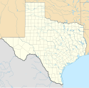
Map of the Catholic diocese of Corpus Christi in the USA.
Autor: Alekjds, Licencja: CC BY 1.0
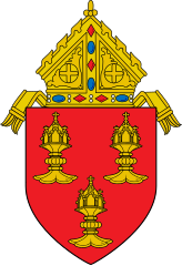
This is a representation of the coat of arms of the Roman Catholic Diocese of Corpus Christi.
Blazon: Gules, three ciboria Or.
The following Commons images were used to create this image:
-
 File:Roman Catholic Diocese of Erie.svg by Niagara (dyskusja · edycje) (mitre)
 -
 File:Old French Escutcheon.svg by Masur (dyskusja · edycje)
 -
 File:Gemeinde Unsernherrn Wappen.svg by Demidow (dyskusja · edycje) and Jüppsche (dyskusja · edycje)


