Diecezja Great Falls-Billings
 Katedra św. Anny w Great Falls | |
| Państwo | |
|---|---|
| Siedziba | Great Falls |
| Data powołania | |
| Wyznanie | |
| Kościół | |
| Metropolia | Portland |
| Katedra diecezjalna |
|
| Biskup diecezjalny | |
| Biskup pomocniczy | Jeffrey Fleming (koadiutor) |
| Biskup senior | |
| Dane statystyczne (2006) | |
| Liczba wiernych • odsetek wiernych | 51 629 |
| Liczba kapłanów • w tym diecezjalnych • w tym zakonnych | 74 |
| Liczba osób zakonnych | 81 |
| Liczba parafii | 66 |
| Powierzchnia | 241 276 km² |
| Strona internetowa | |
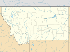
Diecezja Great Falls-Billings (łac. Dioecesis Magnocataractensis-Billingensis, ang. Diocese of Great Falls-Billings) jest diecezją Kościoła rzymskokatolickiego we wschodniej części stanu Montana. Terytorialnie obejmuje hrabstwa: Big Horn, Blaine, Carter, Cascade, Chouteau, Custer, Dawson, Fallon, Fergus, Hill, Musselshell, Park, Rosebud, Sheridan, Stillwater, Sweet Grass, Valley, Wibaux i Yellowstone
Historia
Diecezja została kanonicznie erygowana 18 maja 1904 roku przez papieża Piusa X jako diecezja Great Falls (nazwa zmieniona została 14 lutego 1980). Wyodrębniono ją z diecezji Helena. Pierwszym ordynariuszem został dotychczasowy kapłan archidiecezji Dubuque Mathias Clement Lenihan. Oprócz katedry diecezjalnej w Great Falls diecezja posiada konkatedrę w Billings.
Ordynariusze
- Mathias Clement Lenihan (1904-1930)
- Edwin Vincent O’Hara (1930-1939)
- William Joseph Condon (1939-1967)
- Eldon Bernard Schuster (1967-1977)
- Thomas Murphy (1978-1987)
- Anthony Milone (1987-2006)
- Michael Warfel (od 2007)
Bibliografia
- Oficjalna strona internetowa diecezji Great Falls-Billings
- Diecezja Great Falls-Billings w bazie catholic-hierarchy.org (ang.)
Media użyte na tej stronie
Autor: Uwe Dedering, Licencja: CC BY-SA 3.0
Location map of the USA (without Hawaii and Alaska).
EquiDistantConicProjection:
Central parallel:
* N: 37.0° N
Central meridian:
* E: 96.0° W
Standard parallels:
* 1: 32.0° N
* 2: 42.0° N
Made with Natural Earth. Free vector and raster map data @ naturalearthdata.com.
Formulas for x and y:
x = 50.0 + 124.03149777329222 * ((1.9694462586094064-({{{2}}}* pi / 180))
      * sin(0.6010514667026994 * ({{{3}}} + 96) * pi / 180))
y = 50.0 + 1.6155950752393982 * 124.03149777329222 * 0.02613325650382181
      - 1.6155950752393982  * 124.03149777329222 *
     (1.3236744353715044  - (1.9694462586094064-({{{2}}}* pi / 180))
      * cos(0.6010514667026994 * ({{{3}}} + 96) * pi / 180))
The flag of Navassa Island is simply the United States flag. It does not have a "local" flag or "unofficial" flag; it is an uninhabited island. The version with a profile view was based on Flags of the World and as a fictional design has no status warranting a place on any Wiki. It was made up by a random person with no connection to the island, it has never flown on the island, and it has never received any sort of recognition or validation by any authority. The person quoted on that page has no authority to bestow a flag, "unofficial" or otherwise, on the island.
Japanese map symbol "Church". U+26EA


