Diecezja Kongolo
| Państwo | |
|---|---|
| Siedziba | |
| Data powołania | 1911 |
| Wyznanie | |
| Kościół | |
| Metropolia | |
| Biskup diecezjalny | |
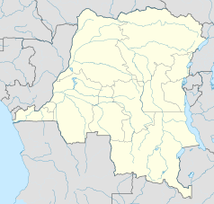
Położenie na mapie Demokratycznej Republiki Konga | |
Diecezja Kongolo – diecezja rzymskokatolicka w Demokratycznej Republice Konga. Powstała w 1911 jako prefektura apostolska Północnej Katangi. Podniesiona do rangi wikariatu apostolskiego w 1935 (od 1951 pod nawą wikariat Kongolo) a diecezji w 1959.
Biskupi diecezjalni
- Biskupi Kongolo
- Bp Oscar Ngoy, C.S.Sp. (od 2007)
- Bp Jérôme Nday Kanyangu Lukundwe (1971– 2007)
- Bp Gustave Joseph Bouve, C.S.Sp. (1959 – 1970)
- Wikariusze apostolscy Kongolo
- Bp Gustave Joseph Bouve, C.S.Sp. (1951 – 1959)
- Wikariusze apostolscy Północnej Katangi
- Bp Gustave Joseph Bouve, C.S.Sp. (1950 – 1951)
- Bp Giorgio Giuseppe Haezaert, C.S.Sp. (1935– 1949)
- Prefekci apostolscy Północnej Katangi
- Bp Giorgio Giuseppe Haezaert, C.S.Sp. (1931– 1935)
- O. Luigi Lempereur, C.S.Sp. (1922 – 1930)
- O. Emilio Callewaert, C.S.Sp. (1912 – 1922)
Bibliografia
http://www.gcatholic.org/dioceses/diocese/kong1.htm Gcatholic]
Media użyte na tej stronie
The national flag of the Democratic Republic of the Congo. Created according to the 2006 constitution : Son emblème est le drapeau bleu ciel, orné d’une étoile jaune dans le coin supérieur gauche et traversé en biais d’une bande rouge finement encadrée de jaune. (Its symbol is a sky blue flag, decorated with a yellow star in the upper left corner and crossed in the diagonal by a red strip with thin yellow borders) It seems to be identical, except for a lighter field hue, to the 1966–1971 flag.
Japanese map symbol "Church". U+26EA
(c) Uwe Dedering z niemieckiej Wikipedii, CC BY 3.0
Location map of Democratic Republic of the Congo
Equirectangular projection. Strechted by 100.0%. Geographic limits of the map:
- N: 6.0° N
- S: -14.0° N
- W: 11.0° E
- E: 32.0° E
Made with Natural Earth. Free vector and raster map data @ naturalearthdata.com.
A new map with the 26 provinces (since 2015) is available here.


