Diepenbeek
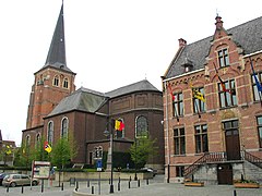
(c) Paul Hermans, CC-BY-SA-3.0 | |||||
| |||||
| Państwo | |||||
|---|---|---|---|---|---|
| Region | |||||
| Prowincja | Limburgia | ||||
| Gmina | Hasselt | ||||
| Burmistrz | Etienne Steegmans | ||||
| Powierzchnia | 41,19 km² | ||||
| Populacja (2008) • liczba ludności • gęstość |
| ||||
| Nr kierunkowy | 011 | ||||
| Kod pocztowy | 3590 | ||||
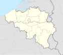
Położenie na mapie Belgii (c) Karte: NordNordWest, Lizenz: Creative Commons by-sa-3.0 de | |||||
| Strona internetowa | |||||
Diepenbeek – miejscowość i gmina w Belgii, w Flandrii, w prowincji Limburgia, koło Hasselt. W 2008 liczyło 18 000 mieszkańców.
Media użyte na tej stronie
Autor: Tom Lemmens, Licencja: CC0
Flag of Flanders (Belgium), the region and community.
(c) Paul Hermans, CC-BY-SA-3.0
Sint-Servatiuskerk en gemeentehuis van Diepenbeek - eigen foto
Municipal flag of Diepenbeek, Belgium.
The municipal flag of Diepenbeek is vertically divided red and yellow with the municipal shield of arms in the middle.Autor: Milenioscuro, Licencja: CC BY-SA 3.0
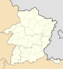
Location map of Limburg province, Belgium
(c) Karte: NordNordWest, Lizenz: Creative Commons by-sa-3.0 de
Location map of Belgium


