Dingwall
 ul. Hil w Dingwall | |
| Państwo | |
|---|---|
| Kraj | |
| Hrabstwo | |
| Populacja (2001) • liczba ludności |
|
| Nr kierunkowy | 01349 |
| Kod pocztowy | IV15 |
Położenie na mapie Highland Contains Ordnance Survey data © Crown copyright and database right, CC BY-SA 3.0 | |
Położenie na mapie Wielkiej Brytanii (c) Karte: NordNordWest, Lizenz: Creative Commons by-sa-3.0 de | |
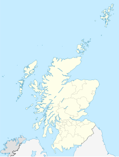
Położenie na mapie Szkocji | |
| Strona internetowa | |
| Portal | |
Dingwall (gaelicki: Inbhir Pheofharain) – miasto portowe w Szkocji, w jednostce administracyjnej Highland, dawniej stolica hrabstwa Ross-shire (następnie Ross and Cromarty), położona nad zatoką Cromarty Firth.
Historia
Dingwall zostało utworzone ok. 1050 przez Thorfinna Sigurdssona – Earla Orkadów. W 1226 król Szkocji Aleksander II wydał przywilej ziemski na mocy którego Dingwall zostało miastem królewskim (en: Royal burgh).
Sławni ludzie
Przypisy
Linki zewnętrzne
- Oficjalna strona miasta (ang.)
- (ang.) http://www.clandavidsonusa.com/dingwall.htm
- Nieodkryta Szkocja (ang.)
Media użyte na tej stronie
(c) Karte: NordNordWest, Lizenz: Creative Commons by-sa-3.0 de
Location map of the United Kingdom
(c) Eric Gaba, NordNordWest, CC BY-SA 3.0
Location map of Scotland, United Kingdom
Contains Ordnance Survey data © Crown copyright and database right, CC BY-SA 3.0
Blank map of Highland, UK with the following information shown:
- Administrative borders
- Coastline, lakes and rivers
- Roads and railways
- Urban areas
Equirectangular map projection on WGS 84 datum, with N/S stretched 180%
Geographic limits:
- West: 6.9W
- East: 2.9W
- North: 58.8N
- South: 56.4N


