Dolgarrog
(c) Jonathan Wilkins, CC BY-SA 2.0 | |
| Państwo | |
|---|---|
| Księstwo | |
| Hrabstwo | |
| Populacja • liczba ludności |
|
| Kod pocztowy | LL32 |
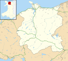
Położenie na mapie Conwy Contains Ordnance Survey data © Crown copyright and database right, CC BY-SA 3.0 | |
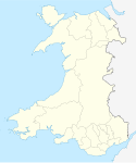
Położenie na mapie Wielkiej Brytanii (c) Karte: NordNordWest, Lizenz: Creative Commons by-sa-3.0 de | |
| Strona internetowa | |
| Portal | |
Dolgarrog – wieś w hrabstwie Conwy w północnej Walii, położone między Llanrwst i Conwy, blisko rzeki Conwy.
Miejscowość jest znana z bogatej historii przemysłu i katastrofy zapory Eigiau, która miała miejsce w 1925 roku. Wieś posiada stację kolejową.
Linki zewnętrzne
- Dolgarrog & Dam Disaster (1925) (ang.). Old Photographs. [dostęp 2012-05-20].
- The DOLGARROG RAILWAY SOCIETY • Keeping Railway History Alive in the Conwy Valley (ang.). [dostęp 2012-05-20].
- Your search for images, within 10km of Dolgarrog, Conwy (ang.). geograph.org.uk. [dostęp 2012-05-20].
Media użyte na tej stronie
(c) Karte: NordNordWest, Lizenz: Creative Commons by-sa-3.0 de
Location map of the United Kingdom
Autor: NordNordWest, Licencja: CC BY-SA 3.0
Location map of Wales, United Kingdom
(c) Jonathan Wilkins, CC BY-SA 2.0
Pelton Wheel The landscaped gardens of Dolgarrog Power Station display this disused pelton wheel rotor from one of their generating sets.
Contains Ordnance Survey data © Crown copyright and database right, CC BY-SA 3.0
Blank map of Conwy, UK with the following information shown:
- Administrative borders
- Coastline, lakes and rivers
- Roads and railways
- Urban areas
Equirectangular map projection on WGS 84 datum, with N/S stretched 165%
Geographic limits:
- West: 4.23W
- East: 3.40W
- North: 53.35N
- South: 52.90N


