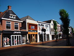
Drachten
| |||||
 | |||||
| Państwo | |||||
| Prowincja | |||||
| Populacja (2007) • liczba ludności | 44443 | ||||
| Kod pocztowy | 9200–9207 | ||||
Drachten – miejscowość w północnej Holandii, we Fryzji. Liczy ok. 44 443 mieszkańców (początek 2007). Największy rozkwit po wybudowaniu przez firmę Philips fabryki w 1950 roku.
Współpraca
Media użyte na tej stronie
Flag of Namibia
Flag of Israel. Shows a Magen David (“Shield of David”) between two stripes. The Shield of David is a traditional Jewish symbol. The stripes symbolize a Jewish prayer shawl (tallit).
Winkels Zuiderbuurt Drachten
Coat of arms of Drachten, Netherlands
Autor: Fryske Rie foar Heraldyk, svg by Arch, Licencja: CC BY-SA 3.0
dorpsvlaggen Friesland
Autor: Erik Frohne, Licencja: CC BY-SA 3.0
Location map of province Friesland in the Netherlands
Equirectangular projection, N/S stretching 164 %. Geographic limits of the map:
- N: 53.60° N
- S: 52.60° N
- W: 4.70° E
- E: 6.50° E


