Dumfries
 | |
| Państwo | |
|---|---|
| Kraj | |
| Hrabstwo | Dumfries and Galloway |
| Data założenia | 1186 |
| Populacja • liczba ludności | 31 600[1] |
| Nr kierunkowy | 01387 |
| Kod pocztowy | DG1–DG2 |
Położenie na mapie Dumfries and Galloway Contains Ordnance Survey data © Crown copyright and database right, CC BY-SA 3.0 | |
Położenie na mapie Wielkiej Brytanii (c) Karte: NordNordWest, Lizenz: Creative Commons by-sa-3.0 de | |
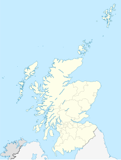
Położenie na mapie Szkocji | |
| Portal | |
Dumfries (wym. /dʌmˈfriːs/; gael. Dùn Phris lub Druim Phris) − miasto w Szkocji, ośrodek administracyjny jednostki Dumfries and Galloway[2], historyczna solica hrabstwa Dumfriesshire. Miejscowość położona jest nad rzeką Nith, nieopodal zatoki Solway Firth[2].
W mieście rozwinął się przemysł chemiczny oraz włókienniczy[3].
Miasta partnerskie
Przypisy
- ↑ Factual Information - Facts and Figures - Dumfries and Galloway, www.dumfries-and-galloway.co.uk [dostęp 2017-11-22].
- ↑ a b Encyklopedia Powszechna PWN. T. 1. Warszawa: Państwowe Wydawnictwo Naukowe, 1973, s. 632.
- ↑ Dumfries, [w:] Encyklopedia PWN [online] [dostęp 2021-06-22].
Media użyte na tej stronie
(c) Karte: NordNordWest, Lizenz: Creative Commons by-sa-3.0 de
Location map of the United Kingdom
The flag of Navassa Island is simply the United States flag. It does not have a "local" flag or "unofficial" flag; it is an uninhabited island. The version with a profile view was based on Flags of the World and as a fictional design has no status warranting a place on any Wiki. It was made up by a random person with no connection to the island, it has never flown on the island, and it has never received any sort of recognition or validation by any authority. The person quoted on that page has no authority to bestow a flag, "unofficial" or otherwise, on the island.
Contains Ordnance Survey data © Crown copyright and database right, CC BY-SA 3.0
Blank map of Dumfries and Galloway, UK with the following information shown:
- Administrative borders
- Coastline, lakes and rivers
- Roads and railways
- Urban areas
Equirectangular map projection on WGS 84 datum, with N/S stretched 170%
Geographic limits:
- West: 5.25W
- East: 2.75W
- North: 55.50N
- South: 54.50N
(c) Eric Gaba, NordNordWest, CC BY-SA 3.0
Location map of Scotland, United Kingdom


