Duncan (Oklahoma)
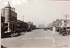
 Duncan około 1920 roku przedstawione na pocztówce | |
| Państwo | |
|---|---|
| Stan | |
| Hrabstwo | |
| Powierzchnia | 123,9 km² |
| Wysokość | 342 m n.p.m. |
| Populacja (2020) • liczba ludności • gęstość |
|
| Nr kierunkowy | 580 |
| Kod pocztowy | 73533-73599 |
| Strona internetowa | |
| Portal | |
Duncan – miasto w Stanach Zjednoczonych, w stanie Oklahoma, w hrabstwie Stephens. Według spisu w 2020 roku liczy 22,7 tys. mieszkańców[1]. Znane jako miejsce narodzin korporacji Halliburton.
Założone w 1892 roku wraz z pojawieniem się pierwszej kolei. Po odkryciu ropy naftowej w 1921 r. przemysł naftowy zastąpił rolnictwo jako podstawową działalność gospodarczą[2].
Przypisy
- ↑ U.S. Census Bureau QuickFacts: Duncan city, Oklahoma, www.census.gov [dostęp 2022-11-20] (ang.).
- ↑ Duncan - Oklahoma, United States, www.britannica.com [dostęp 2022-11-20] (ang.).
Media użyte na tej stronie
Autor: Uwe Dedering, Licencja: CC BY-SA 3.0
Location map of the USA (without Hawaii and Alaska).
EquiDistantConicProjection:
Central parallel:
* N: 37.0° N
Central meridian:
* E: 96.0° W
Standard parallels:
* 1: 32.0° N
* 2: 42.0° N
Made with Natural Earth. Free vector and raster map data @ naturalearthdata.com.
Formulas for x and y:
x = 50.0 + 124.03149777329222 * ((1.9694462586094064-({{{2}}}* pi / 180))
      * sin(0.6010514667026994 * ({{{3}}} + 96) * pi / 180))
y = 50.0 + 1.6155950752393982 * 124.03149777329222 * 0.02613325650382181
      - 1.6155950752393982  * 124.03149777329222 *
     (1.3236744353715044  - (1.9694462586094064-({{{2}}}* pi / 180))
      * cos(0.6010514667026994 * ({{{3}}} + 96) * pi / 180))
The flag of Navassa Island is simply the United States flag. It does not have a "local" flag or "unofficial" flag; it is an uninhabited island. The version with a profile view was based on Flags of the World and as a fictional design has no status warranting a place on any Wiki. It was made up by a random person with no connection to the island, it has never flown on the island, and it has never received any sort of recognition or validation by any authority. The person quoted on that page has no authority to bestow a flag, "unofficial" or otherwise, on the island.
Autor: Alexrk, Licencja: CC BY 3.0
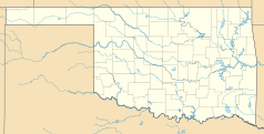
Ta mapa została stworzona za pomocą GeoTools.
Autor: Nieznany, Licencja: CC0
Looking west down Main St. The building with the turret on the left was the City Hall, police & fire. I can recall that building as a small boy. The old Stephens County Courthouse can be seen at the other end of Main. Circa 1920.


