Dunkeld
(c) Martin Addison, CC BY-SA 2.0 | |
| Państwo | |
|---|---|
| Kraj | |
| Hrabstwo | |
| Powierzchnia | 1.08 km² |
| Populacja (2019) • liczba ludności • gęstość |
|
| Kod pocztowy | PH8 |
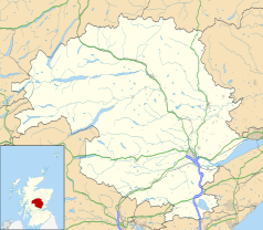
Położenie na mapie Perth and Kinross Contains Ordnance Survey data © Crown copyright and database right, CC BY-SA 3.0 | |
Położenie na mapie Wielkiej Brytanii (c) Karte: NordNordWest, Lizenz: Creative Commons by-sa-3.0 de | |
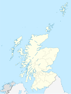
Położenie na mapie Szkocji | |
| 56,5661°N 3,5860°W/56,566100 -3,586000 | |
| Strona internetowa | |
| Portal | |
Dunkeld – miasto w Szkocji, w Perth and Kinross. Leży nad rzeką Tay, 24 km od miasta Perth[1]. W 2019 roku miasto liczyła 1360 mieszkańców (w tym Birnam). W 1704 roku stał się burgh. Ma katedrę[2].
Przypisy
- ↑ Dunkeld. Gazetteer for Scotland. [dostęp 2020-10-03]. (ang.).
- ↑ Dunkeld, [w:] Encyclopædia Britannica [online] [dostęp 2020-10-03] (ang.).
Media użyte na tej stronie
(c) Karte: NordNordWest, Lizenz: Creative Commons by-sa-3.0 de
Location map of the United Kingdom
Contains Ordnance Survey data © Crown copyright and database right, CC BY-SA 3.0
Blank map of Perth and Kinross, UK with the following information shown:
- Administrative borders
- Coastline, lakes and rivers
- Roads and railways
- Urban areas
Equirectangular map projection on WGS 84 datum, with N/S stretched 180%
Geographic limits:
- West: 4.80W
- East: 2.95W
- North: 57.00N
- South: 56.10N
(c) Martin Addison, CC BY-SA 2.0
Dunkeld From The Air The town of Dunkeld is in the foreground with the cathedral visible to the right. Across the Tay at the other end of the bridge carrying the A923 is Little Dunkeld. The major road on the other side of the river is the A9.
(c) Eric Gaba, NordNordWest, CC BY-SA 3.0
Location map of Scotland, United Kingdom


