Dystrykt Tema
| dystrykt stołeczny | |
| Państwo | |
|---|---|
| Region | Greater Accra |
| Siedziba | Tema |
| Kod ISO 3166-2 | GH-AA-TE |
| Zarządzający | David Annang |
| Powierzchnia | 565 km² |
| Populacja (2002) • liczba ludności | 506,637 |
| Plan | |
 | |
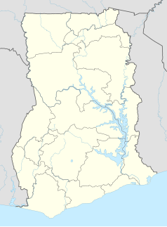
Położenie na mapie Ghany (c) Karte: NordNordWest, Lizenz: Creative Commons by-sa-3.0 de | |
Dystrykt Stołeczny Tema - jest miastem i zarazem dystryktem w Regionie Greater Accra w Ghanie. Zajmuje powierzchnię 565 km², populacja w roku 2002 wynosiła 506.637 mieszkańców.
Dystrykt składa się z dwudziestu sześciu gmin:
| Tema Community 1 | Tema Newtown |
| Tema Community 2 | Tema Wharf |
| Tema Community 3 | Lashibi |
| Tema Community 4 | Bethlehem |
| Tema Community 5 | Kakasunanka II |
| Tema Community 6 | Adenta East |
| Tema Community 7 | Ashaley Botwe |
| Tema Community 8 | Ashiaman |
| Tema Community 9 | Kpone |
| Tema Community 10 | Ogbojo |
| Tema Community 11 | ? |
| Tema Community 12 | ? |
| Tema Community 13 | ? |
Bibliografia
Media użyte na tej stronie
(c) Karte: NordNordWest, Lizenz: Creative Commons by-sa-3.0 de
Location map of Ghana
Map of the districts of the Greater Accra region of Ghana. Created by Rarelibra for public domain use. Created using MapInfo Professional v7.5 and various mapping resources.


