Dzielnica Łacińska
| ||||
| ||||
 Uliczka w Dzielnicy Łacińskiej | ||||
| Państwo | ||||
| Region | ||||
| Miasto | Paryż | |||
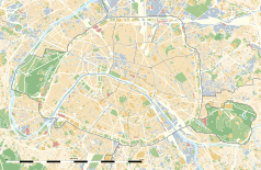
Położenie na mapie Paryża (c) Eric Gaba, Wikimedia Commons user Sting, CC BY-SA 3.0 | ||||
| Portal | ||||
| Ten artykuł od 2015-06 wymaga zweryfikowania podanych informacji. |
Dzielnica Łacińska (fr. Quartier latin) – uniwersytecka dzielnica Paryża obejmująca północną część V dzielnicy oraz wschodni kawałek dzielnicy VI. W VI wieku założono tu opactwo Sainte-Geneviève, w XII – Saint-Victor. Poza tym znajdują się tu m.in. kompleks klasztorny benedyktynów Val-de-Grâce, zamieniony po rewolucji francuskiej w szpital wojskowy, dawne opactwo Port-Royal, Kolegium Francuskie, Sorbona, Panteon, muzeum Cluny.
Nazwa dzielnicy pochodzi od języka łacińskiego, którym w średniowieczu i aż do Rewolucji posługiwano się powszechnie na uniwersytetach.
Galeria zdjęć
Pałac Luksemburski (w którym mieści się Senat) i Ogród Luksemburski)
Musée de Cluny (hôtel Cluny)
Media użyte na tej stronie
(c) Eric Gaba, Wikimedia Commons user Sting, CC BY-SA 3.0
Blank land cover map of the city and department of Paris, France, as in January 2012, for geo-location purpose, with distinct boundaries for departments and arrondissements.
Autor: Superbenjamin, Licencja: CC BY-SA 4.0
Blank administrative map of France for geo-location purpose, with regions and departements distinguished. Approximate scale : 1:3,000,000
Autor: Thibault Pelloquin, Licencja: CC BY-SA 3.0
Cette carte représente l'Île de France (en jaune pâle), ses limites départementales et régionales (en traits gris) et ses principaux cours et points d'eau (en bleu). Les départements limitrophes (sont en rose-orange pâle)
Autor: Mbzt, Licencja: CC BY-SA 4.0
Chapelle Sainte-Ursule de la Sorbonne - Paris V
Autor: François Trazzi, Licencja: CC-BY-SA-3.0
Musée national du Moyen Âge de Paris
(c) Roi Boshi, CC BY-SA 3.0
Standing statue of Guillaume Budé in the courtyard of the Collège de France.


