Edgar Street
 | |
| Edgar Street Athletic Ground | |
| Państwo | |
|---|---|
| Kraj | |
| Adres | |
| Data otwarcia | koniec XIX w. (dokładna data nie jest znana) |
| Klub | Hereford FC |
| Pojemność stadionu | 7 691 (2 761 siedących) |
| Nawierzchnia boiska | trawa |
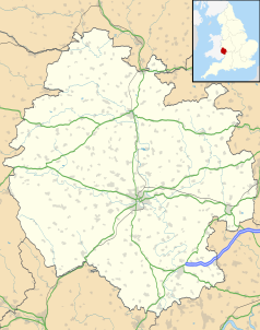
Położenie na mapie Herefordshire Contains Ordnance Survey data © Crown copyright and database right, CC BY-SA 3.0 | |
Położenie na mapie Wielkiej Brytanii (c) Karte: NordNordWest, Lizenz: Creative Commons by-sa-3.0 de | |
Edgar Street stadion piłkarski położony w mieście Hereford w Wielkiej Brytanii. Oddany został do użytku pod koniec XIX w. (dokładna data nie jest znana). Swoje mecze na tym obiekcie rozgrywał zespół Hereford United F.C., jego pojemność wynosi 7 100 miejsc (w tym 2 761 siedących). Obecnie na stadionie gra Hereford FC.
Media użyte na tej stronie
(c) Karte: NordNordWest, Lizenz: Creative Commons by-sa-3.0 de
Location map of the United Kingdom
Flag of England. Saint George's cross (a red cross on a white background), used as the Flag of England, the Italian city of Genoa and various other places.
Autor:
- Gfi-set01-stadium.png: gfi
- derivative work: Frédéric (talk)
icone pour terrain de sport
View of the home section of the Floors-2-Go (Len Weston) stand and the Meadow End at Edgar Street, Hereford - from the perspective of the Blackfriars Street End
Contains Ordnance Survey data © Crown copyright and database right, CC BY-SA 3.0
Map of Herefordshire, UK with the following information shown:
- Administrative borders
- Coastline, lakes and rivers
- Roads and railways
- Urban areas
Equirectangular map projection on WGS 84 datum, with N/S stretched 160%
Geographic limits:
- West: 3.15W
- East: 2.33W
- North: 52.45N
- South: 51.80N


