Edisto
 Kościół Prezbiteriański na Edisto Island | |
| Kontynent | |
|---|---|
| Państwo | |
| Stan | |
| Akwen | |
| Powierzchnia | 175,5 km² |
| Populacja (2000) • liczba ludności • gęstość |
|
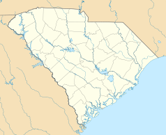
Edisto, Edisto Island – jedna z wysp należących do Sea Islands, leżąca u wybrzeży Karoliny Południowej w hrabstwie Charleston. Wyspę w 2000 roku zamieszkiwało 2301 mieszkańców. Na wyspie jest niewielka miejscowość Edisto Beach. Na wyspie zachowały się wspaniałe budynki właścicieli ziemskich z okresu kolonialnego, gdy były na niej plantacje ryżu, bawełny i indygo. Obecnie jest to znany resort wypoczynkowy[1]. Wyspa jest miejscem urodzenia Jamesa Jamersona legendarnego muzyka soulowego.
Przypisy
- ↑ Edisto ISland (ang.). [dostęp 2011-06-05]. [zarchiwizowane z tego adresu (2012-03-10)].
Media użyte na tej stronie
Autor: Uwe Dedering, Licencja: CC BY-SA 3.0
Relief location map of the USA (without Hawaii and Alaska).
EquiDistantConicProjection : Central parallel :
* N: 37.0° N
Central meridian :
* E: 96.0° W
Standard parallels:
* 1: 32.0° N
* 2: 42.0° N
Made with Natural Earth. Free vector and raster map data @ naturalearthdata.com.
Formulas for x and y:
x = 50.0 + 124.03149777329222 * ((1.9694462586094064-({{{2}}}* pi / 180))
      * sin(0.6010514667026994 * ({{{3}}} + 96) * pi / 180))
y = 50.0 + 1.6155950752393982 * 124.03149777329222 * 0.02613325650382181
      - 1.6155950752393982  * 124.03149777329222 *
     (1.3236744353715044  - (1.9694462586094064-({{{2}}}* pi / 180))
      * cos(0.6010514667026994 * ({{{3}}} + 96) * pi / 180))
The flag of Navassa Island is simply the United States flag. It does not have a "local" flag or "unofficial" flag; it is an uninhabited island. The version with a profile view was based on Flags of the World and as a fictional design has no status warranting a place on any Wiki. It was made up by a random person with no connection to the island, it has never flown on the island, and it has never received any sort of recognition or validation by any authority. The person quoted on that page has no authority to bestow a flag, "unofficial" or otherwise, on the island.
Edisto Island Presbyterian Church, Edisto Island (Charleston County, South Carolina) (cropped)
Autor: Alexrk, Licencja: CC BY 3.0
Ta mapa została stworzona za pomocą GeoTools.


