Eindewege
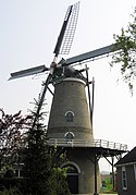
 Wiatrak Nooit Gedacht | |
| Państwo | |
|---|---|
| Prowincja | |
| Prowincja | |
| Populacja (2010) • liczba ludności |
|
Eindewege – wieś w gminie Goes w prowincji Zelandii. W miejscowości znajduje się wybudowany w 1872 wiatrak o nazwie Nooit Gedacht[1][2].
Przypisy
- ↑ Eindewege ('s-Heer Arendskerke), Zeeland (niderl.). molendatabase.nl. [dostęp 2017-01-01].
- ↑ Home (niderl.). molennooitgedacht.nl. [dostęp 2017-01-01].
Media użyte na tej stronie
Autor: Erik Frohne, Licencja: CC BY-SA 3.0
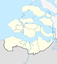
Location map of province Zeeland in the Netherlands
Equirectangular projection, N/S stretching 160 %. Geographic limits of the map:
- N: 51.80° N
- S: 51.10° N
- W: 3.30° E
- E: 4.30° E
Autor: Fvlamoen 08:30, 26 April 2007 (UTC), Licencja: CC-BY-SA-3.0
Windmill Nooit Gedacht, Eindewege


