Elahuizen
 | |||
| |||
| Państwo | |||
|---|---|---|---|
| Prowincja | |||
| Populacja (2004) • liczba ludności | ok. 330 | ||
| Kod pocztowy | 8581 | ||
Elahuizen – wieś położona w północnej Holandii, we Fryzji, w gminie Gaasterland-Sloten.
Media użyte na tej stronie
Coat of arms of Gaasterland-Sloten (Netherlands)
Autor: Jan dijkstra, Licencja: CC BY-SA 3.0
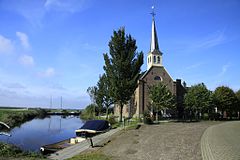
To jest zdjęcie holenderskiego zabytku (rijksmonument) numer 481742
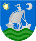
Coat of arms of Elahuizen Netherlands.
Autor: Erik Frohne, Licencja: CC BY-SA 3.0
Location map of province Friesland in the Netherlands
Equirectangular projection, N/S stretching 164 %. Geographic limits of the map:
- N: 53.60° N
- S: 52.60° N
- W: 4.70° E
- E: 6.50° E


