Enriquillo
| Ten artykuł od 2014-04 wymaga zweryfikowania podanych informacji. |
| ||
 Zdjęcie satelitarne jeziora | ||
| Położenie | ||
| Państwo | ||
| Wysokość lustra | -46 m n.p.m. | |
| Morfometria | ||
| Powierzchnia | 265 km² | |
| Głębokość • maksymalna | 52 m | |
| Hydrologia | ||
| Rzeki zasilające | Yaque del Sur | |
| Rodzaj jeziora | słone | |
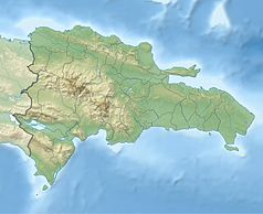
Enriquillo (hiszp. Lago Enriquillo) – słone jezioro w Dominikanie, położone w południowo-zachodniej części kraju. Współrzędne geograficzne: 18°30′N 71°35′W/18,500000 -71,583333. Jezioro położone jest w rowie tektonicznym, który tworzy w tym miejscu depresję. Nad jeziorem wznoszą się pasma górskie: Sierra de Neiba (na północy) i Sierra de Bahoruco (na południu). Brzeg jeziora położony jest 46 m p.p.m. Stanowi on najniżej położony punkt w kraju, a zarazem całej Ameryki Środkowej. Jezioro zajmuje powierzchnię 265 km².
Zobacz też
Media użyte na tej stronie
The flag of the Dominican Republic has a centered white cross that extends to the edges. This emblem is similar to the flag design and shows a bible, a cross of gold and 6 Dominican flags. There are branches of olive and palm around the shield and above on the ribbon is the motto "Dios,Patria!, Libertad" ("God, Country, Freedom") and to amiable freedom. The blue is said to stand for liberty, red for the fire and blood of the independence struggle and the white cross symbolized that God has not forgotten his people. "Republica Dominicana". The Dominican flag was designed by Juan Pablo Duarte, father of the national Independence of Dominican Republic. The first dominican flag was sewn by a young lady named Concepción Bona, who lived across the street of El Baluarte, monument where the patriots gathered to fight for the independence, the night of February 27th, 1844. Concepción Bona was helped by her first cousin María de Jesús Pina.
Autor: Tzugaj, Licencja: CC0
znak graficzny do map, ukazujący przykładowe jezioro
Lake Enriquillo, Dominican Republic - September 1993
Autor: Alexrk2, Licencja: CC BY-SA 3.0
Physical Location map Dominican Republic with Provinces, Equirectangular projection, N/S stretching 105 %. Geographic limits of the map:


