Etten-Leur
| |||||
 | |||||
| Państwo | |||||
| Prowincja | Brabancja Północna | ||||
| Burmistrz | Hélène van Rijnbach-de Groot (2014)[1] | ||||
| Powierzchnia | 55,88 km² | ||||
| Populacja (2014) • liczba ludności • gęstość | 42 395 730 os./km² | ||||
| Nr kierunkowy | 076 | ||||
| Kod pocztowy | 4870-4879 | ||||
 | |||||
| Strona internetowa | |||||
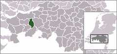
Etten-Leur − miasto w południowej Holandii, na terenie Brabancji Północnej. Nazwa miasta powstała w wyniku połączenia miasta Etten i wsi Leur w 1968. W mieście znajduje się przystanek kolejowy.
Przypisy
- ↑ etten-leur.nl: Het college van burgemeester en wethouders - samenstelling per 12 mei 2014 (niderl.). [dostęp 2014-07-10]. [zarchiwizowane z tego adresu (2014-05-14)].
Media użyte na tej stronie
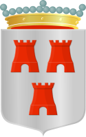
Coat of arms of the Dutch municipality of Etten-Leur.
Nederland, Noord-Brabant, Gemeente Etten-Leur
Autor: Gestebier, Licencja: CC BY-SA 4.0
ZIcht op molen De Lelie en de Geerkade in Etten-Leur
Autor: Erik Frohne, Licencja: CC BY-SA 3.0
Location map of province North Brabant in the Netherlands
Equirectangular projection, N/S stretching 161 %. Geographic limits of the map:
- N: 51.90° N
- S: 51.20° N
- W: 4.10° E
- E: 6.10° E


