Everton (Liverpool)
| ||||
| ||||
 Wieża ciśnień w dzielnicy Everton | ||||
| Państwo | ||||
|---|---|---|---|---|
| Kraj | ||||
| Region | North West England | |||
| Hrabstwo ceremonialne | Merseyside | |||
| Unitary authority | Liverpool | |||
| Miasto | Liverpool | |||
| Populacja (2011) • liczba ludności | 14 782 | |||
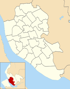
Położenie na mapie Liverpoolu Contains Ordnance Survey data © Crown copyright and database right, CC BY-SA 3.0 | ||||
Położenie na mapie Wielkiej Brytanii (c) Karte: NordNordWest, Lizenz: Creative Commons by-sa-3.0 de | ||||
Położenie na mapie Merseyside Contains Ordnance Survey data © Crown copyright and database right, CC BY-SA 3.0 | ||||
| 53°25′08″N 2°57′58″W/53,418800 -2,966100 | ||||
| Portal | ||||
Everton – dzielnica Liverpoolu, miasta w Anglii, w Merseyside, w dystrykcie (unitary authority) Liverpool[1]. Według danych ze spisu z 2011 r. zamieszkana przez 14 782 osób[2].
Obiekty zabytkowe
- Wieża ciśnień (Everton Water Tower) z 1864 r.
- Anglikański Kościół św. Jerzego z 1814 r.
Zobacz też
Przypisy
- ↑ Ordnance Survey linked data
- ↑ Wyniki spisu powszechnego z 2011 r. [1]
Media użyte na tej stronie
(c) Karte: NordNordWest, Lizenz: Creative Commons by-sa-3.0 de
Location map of the United Kingdom
Flag of England. Saint George's cross (a red cross on a white background), used as the Flag of England, the Italian city of Genoa and various other places.
Contains Ordnance Survey data © Crown copyright and database right, CC BY-SA 3.0
Map of Liverpool, Merseyside, UK with electoral wards shown.
Equirectangular map projection on WGS 84 datum, with N/S stretched 165%
Geographic limits:
- West: 3.02W
- East: 2.80W
- North: 53.48N
- South: 53.31N
Contains Ordnance Survey data © Crown copyright and database right, CC BY-SA 3.0
Map of Merseyside, UK with the following information shown:
- Administrative borders
- Coastline, lakes and rivers
- Roads and railways
- Urban areas
Equirectangular map projection on WGS 84 datum, with N/S stretched 165%
Geographic limits:
- West: 3.24W
- East: 2.54W
- North: 53.72N
- South: 53.27N
Autor: Ta PNG grafika rastrowa została stworzona za pomocą Inkscape ., Licencja: CC BY-SA 3.0
The Coat of arms of Liverpool City Council, the local government authority for the City of Liverpool in Merseyside, England. The blazon is:
ARMS: Argent a Cormorant in the beak a Branch of Seaweed called Laver all proper.
CREST: On a Wreath of the Colours a Cormorant the wings elevated in the beak a Branch of Laver proper.
Autor: KGGucwa, Licencja: CC BY-SA 3.0
Wieża ciśnień (Everton Water Tower) w Liverpoolu
Autor: Rodhullandemu, Licencja: CC BY-SA 4.0
Grade I listed church in Everton, Liverpool, north side.


