Farvel
| ||
 Przylądek Farvel widziany z kosmosu | ||
| Państwo | ||
| Terytorium zależne | ||
| Rodzaj obiektu | przylądek | |
Farvel (gren.: Uummannarsuaq; duń.: Kap Farvel) – przylądek na wyspie Egger, najdalej na południe wysunięty punkt Grenlandii. Znajduje się na terenie gminy Kujalleq. Znajduje się na takiej szerokości geograficznej, jak Petersburg, Oslo i Szetlandy.
Bibliografia
- Farvel, [w:] Encyklopedia PWN [online] [dostęp 2012-11-24].
Media użyte na tej stronie
Cape Farewell (the centre of the image) and the rugged southern coast of Egger Island, The coast (dark) is generally surrounded by sea ice, making navigation treacherous.
Autor: Uwe Dedering, Licencja: CC BY-SA 3.0
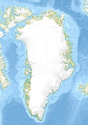
Relief location map of Greenland.
- Projection: EquiDistantConicProjection.
- Area of interest:
- N: 85.0° N
- S: 59.0° N
- W: -75.0° E
- E: -10.0° E
- Projection center:
- NS: 72.0° N
- WE: -42.5° E
- Standard parallels:
- 1: 64.0° N
- 2: 80.0° N
- GMT projection: -JD-42.5/72/64/80/20c
- GMT region: -R-60.16/57.61/24.5/79.91r
- GMT region for grdcut: -R-120.24/57.61/24.5/85.78r
- Relief: SRTM30plus.
- Made with Natural Earth. Free vector and raster map data @ naturalearthdata.com.


