Feale
 | |||||||||||||||||||||||||||||||||||||
| Kontynent | |||||||||||||||||||||||||||||||||||||
|---|---|---|---|---|---|---|---|---|---|---|---|---|---|---|---|---|---|---|---|---|---|---|---|---|---|---|---|---|---|---|---|---|---|---|---|---|---|
| Państwo | |||||||||||||||||||||||||||||||||||||
| Lokalizacja | |||||||||||||||||||||||||||||||||||||
| Rzeka | |||||||||||||||||||||||||||||||||||||
| Długość | 75 km | ||||||||||||||||||||||||||||||||||||
| Powierzchnia zlewni | 445 km² | ||||||||||||||||||||||||||||||||||||
| Źródło | |||||||||||||||||||||||||||||||||||||
| Miejsce | Góry Mullaghareirk | ||||||||||||||||||||||||||||||||||||
| Wysokość | 310 | ||||||||||||||||||||||||||||||||||||
| Współrzędne | |||||||||||||||||||||||||||||||||||||
| Ujście | |||||||||||||||||||||||||||||||||||||
| Recypient | estuarium rzeki Shannon, Ocean Atlantycki | ||||||||||||||||||||||||||||||||||||
| Miejsce | Ballybunion | ||||||||||||||||||||||||||||||||||||
| Wysokość | 0 | ||||||||||||||||||||||||||||||||||||
| Współrzędne | |||||||||||||||||||||||||||||||||||||
| Szlak | |||||||||||||||||||||||||||||||||||||
| |||||||||||||||||||||||||||||||||||||
Feale (irl. An Fhéil, Abhainn na Féile) – rzeka w Irlandii przepływająca przez hrabstwa: Cork, Limerick i Kerry.
Wypływa z Gór Mullaghareirk w hrabstwie Cork, niedaleko Ardnageeha, rozdzielając hrabstwa Limerick i Kerry płynie do Abbyfeale. Od tego miejsca, przez ostatnie 10 km nazwana jest także Cashen, od zatoki Cashen, którą wpływa do Oceanu Atlantyckiego w Ballybunion. Najważniejszymi dopływami są rzeki: Breanagh, Casher, Deel, Clydagh, Glashacooncore, Owveg, Smearlagh, Allaghan, Oolagh, Galey[1].
W rzece występują m.in. pstrąg i łosoś, i od marca do września jest ona miejscem wędkowania[1][2].
Przypisy
- ↑ a b Fishing Ireland: River Feale.
- ↑ Salmon Ireland: River Feale. salmon-ireland.com. [zarchiwizowane z tego adresu (2013-04-23)]..
Media użyte na tej stronie
River Feale as seen in Summer 2005 at Finuge crossing linking Finuge to Killocrim, near Listowel, Kerry, Ireland.
(c) Warren Buckley, CC BY-SA 2.0
Listowel Bridge, Co Kerry. Bridge of the River Feale in Listowel, Co. Kerry
Autor: Roger Zenner, Licencja: CC BY-SA 2.0 de
Neue Karte von Irland und Nordirland
Autor: Nilfanion, Licencja: CC BY-SA 3.0
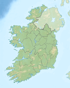
Relief location map of Ireland
Equirectangular map projection on WGS 84 datum, with N/S stretched 170%
Geographic limits:
- West: 11.0° W
- East: 5.0° W
- North: 55.6° N
- South: 51.2° N


