Fexhe-le-Haut-Clocher
| |||||
 | |||||
| Państwo | |||||
| Region | Walonia | ||||
| Prowincja | Liège | ||||
| Dystrykt | Waremme | ||||
| Burmistrz | Henri Christophe | ||||
| Powierzchnia | 19,25 km² | ||||
| Populacja (2017) • liczba ludności • gęstość | 3263 169 os./km² | ||||
| Nr kierunkowy | 04 | ||||
| Kod pocztowy | 4347 | ||||
| Strefa czasowa | UTC+01:00 | ||||
| Strona internetowa | |||||
Fexhe-le-Haut-Clocher (fɛksləoklɔʃe, waloński Fèhe-å-Hôt-Clokî) – miejscowość i gmina w Belgii, w Regionie Walońskim, we Francuskiej Wspólnocie Belgii, w prowincji Liège, w dystrykcie Waremme. Według Dyrekcji Generalnej Instytucji i Ludności, 1 stycznia 2017 roku gmina liczyła 3263 mieszkańców[1].
Przypisy
- ↑ Chiffres de la population par province et par commune, à la date du premier janvier 2017 (fr.). Direction générale Institutions et Population. [dostęp 2018-08-04].
Linki zewnętrzne
Media użyte na tej stronie
Autor: Milenioscuro, Licencja: CC BY-SA 3.0
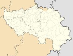
Location map of Liège province, Belgium
Autor: Jean-Pol GRANDMONT, Licencja: CC BY 2.5
Fexhe-le-Haut-Clocher (Belgium), the St. Martin's church (XII/XVIIth centuries).
Autor: Caranorn, Licencja: CC-BY-SA-3.0
Armoiries de la commune de Fexhe-le-Haut-Clocher, blasonné : de gueules au lion à la queue fourchée et passée en sautoir d'argent, armé, lampassé et couronné d'or.
Flag of Fexhe-Le-Haut-Clocher, in Liège province, Belgium. Description from FOTW: The flag is divided red-white by a line broken three times at right angle, starting from the third fourth of the upper edge of the flag and reaching the first fourth of the lower edge of the flag.


