Fiodorowskij
| |||||
| |||||
| Państwo | |||||
| Okręg autonomiczny | |||||
| Data założenia | 1984 | ||||
| Wysokość | 60 m n.p.m. | ||||
| Populacja (2010) • liczba ludności | 20 292 | ||||
| Nr kierunkowy | +7 3462 | ||||
| Kod pocztowy | 628456 | ||||
| Tablice rejestracyjne | 86 | ||||
| Strona internetowa | |||||
| Portal | |||||
Fiodorowskij (ros.Фёдоровский) - osiedle typu miejskiego w azjatyckiej części Rosji, we wchodzącym w skład tego państwa Chanty-Mansyjskim Okręgu Autonomicznym - Jugrze, położonym na zachodniej Syberii.
Osada liczy 20.292 mieszkańców (1 stycznia 2010 r.), głównie Rosjan i innych europejskich osadników. Niewielki udział w populacji miasta mają też rdzenni mieszkańcy Okręgu - Chantowie i Mansowie.
Zobacz też
- Chanty-Mansyjski Okręg Autonomiczny - Jugra
Media użyte na tej stronie
Autor: Uwe Dedering, Licencja: CC BY-SA 3.0
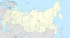
Location map of Russia.
EquiDistantConicProjection : Central parallel :
* N: 54.0° N
Central meridian :
* E: 100.0° E
Standard parallels:
* 1: 49.0° N
* 2: 59.0° N
Made with Natural Earth. Free vector and raster map data @ naturalearthdata.com.
Because the southern Kuril islands are claimed by Russia and Japan, they are shown as disputed. For more information about this see: en:Kuril Islands dispute. These islands are since 1945 under the jurisdiction of the Russian Federation.
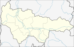
Autor: WWay, Deviritative work from Khanty-Mansiysky AO.png by СафроновАВ (Russian Wikipedia), Licencja: CC BY-SA 3.0
Geolocation map for Khnaty-Mansi's Autonomous District of Yugra (Russia)
Coat of arms of Yugra (Khanty-Mansia), Russia, since 24 December 2020
Flag of Fyodorovsky, Khanty-Mansyisky AO, Russia
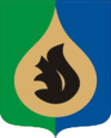
Coat of arms of Fyodorovsky (Khanty-Mansi Autonomous Okrug), 2008


