FirstEnergy Stadium
| ||
 FirstEnergy Stadium w 2012 roku | ||
| Państwo | ||
| Miejscowość | Cleveland | |
| Adres | 100 Alfred Lerner Way Cleveland, Ohio 44114 | |
| Architekt | Populous | |
| Koszt budowy | $349 000 000 | |
| Data budowy | 1997-1999 | |
| Data otwarcia | 12 września 1999 | |
| Właściciel | Miasto Cleveland | |
| Klub | Cleveland Browns | |
| Pojemność stadionu | 73 200 | |
| Nawierzchnia boiska | Wiechlina łąkowa[1] | |
| Strona internetowa | ||
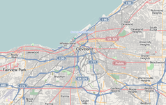
FirstEnergy Stadium – stadion w Cleveland, w stanie Ohio w Stanach Zjednoczonych. Na tym obiekcie swoje spotkania rozgrywa drużyna NFL Cleveland Browns. Stadion może pomieścić 73 200 widzów[1]. Odbywają się na nim różne wydarzenia, jak np. mecze futbolu amerykańskiego, piłki nożnej czy koncerty.
Przypisy
- ↑ a b About the stadium (ang.). Cleveland Browns. [dostęp 2012-06-23]. [zarchiwizowane z tego adresu (2011-02-13)].
Media użyte na tej stronie
Autor: Uwe Dedering, Licencja: CC BY-SA 3.0
Location map of the USA (without Hawaii and Alaska).
EquiDistantConicProjection:
Central parallel:
* N: 37.0° N
Central meridian:
* E: 96.0° W
Standard parallels:
* 1: 32.0° N
* 2: 42.0° N
Made with Natural Earth. Free vector and raster map data @ naturalearthdata.com.
Formulas for x and y:
x = 50.0 + 124.03149777329222 * ((1.9694462586094064-({{{2}}}* pi / 180))
      * sin(0.6010514667026994 * ({{{3}}} + 96) * pi / 180))
y = 50.0 + 1.6155950752393982 * 124.03149777329222 * 0.02613325650382181
      - 1.6155950752393982  * 124.03149777329222 *
     (1.3236744353715044  - (1.9694462586094064-({{{2}}}* pi / 180))
      * cos(0.6010514667026994 * ({{{3}}} + 96) * pi / 180))
Autor: Alexrk2, Licencja: CC BY 3.0
Ta mapa została stworzona za pomocą GeoTools.
The flag of Navassa Island is simply the United States flag. It does not have a "local" flag or "unofficial" flag; it is an uninhabited island. The version with a profile view was based on Flags of the World and as a fictional design has no status warranting a place on any Wiki. It was made up by a random person with no connection to the island, it has never flown on the island, and it has never received any sort of recognition or validation by any authority. The person quoted on that page has no authority to bestow a flag, "unofficial" or otherwise, on the island.
Autor:
- Gfi-set01-stadium.png: gfi
- derivative work: Frédéric (talk)
icone pour terrain de sport
Autor: , Licencja: CC BY-SA 2.0


