Fond du Lac (Wisconsin)
 Zabytkowe centrum Fond du Lac | |
| Państwo | |
|---|---|
| Stan | |
| Hrabstwo | |
| Data założenia | 1847 |
| Prawa miejskie | 1852 |
| Powierzchnia | 48,7 km² |
| Populacja (2013) • liczba ludności • gęstość |
|
| Nr kierunkowy | 920 |
| Kod pocztowy | 54935, 54936, 54937 |
| Strona internetowa | |
| Portal | |
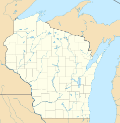
Fond du Lac – miasto (city), ośrodek administracyjny hrabstwa Fond du Lac, we wschodniej części stanu Wisconsin, w Stanach Zjednoczonych, położone nad rzeką Fond du Lac, na południowym brzegu jeziora Winnebago[1]. W 2013 roku miasto liczyło 42 970 mieszkańców[2].
Obszar ten zamieszkany był początkowo przez indiańskie plemię Winebagów. W 1785 roku Francuzi założyli tutaj placówkę handlową, którą nazwali Fond du Lac (z fr. „spód jeziora”). W 1833 roku rozplanowana została miejscowość, formalnie założona w 1847 roku. W 1852 roku Fond du Lac uzyskało prawa miejskie[1].
Początkowo lokalna gospodarka opierała się na przemyśle drzewnym i uprawie zbóź. Obecnie istotną rolę odgrywa hodowla bydła oraz przemysł maszynowy i środków transportu[1].
W Fond du Lac swoją siedzibę mają uczelnie Marian University oraz University of Wisconsin–Fond du Lac[1].
Przypisy
- ↑ a b c d Fond du Lac, [w:] Encyclopædia Britannica [online] [dostęp 2014-09-23] (ang.).
- ↑ Fond du Lac (city), Wisconsin. QuickFacts from the US Census Bureau. [dostęp 2014-09-23]. (ang.).
Media użyte na tej stronie
Autor: Alexrk2, Licencja: CC BY 3.0
Ta mapa została stworzona za pomocą GeoTools.
Autor: Uwe Dedering, Licencja: CC BY-SA 3.0
Location map of the USA (without Hawaii and Alaska).
EquiDistantConicProjection:
Central parallel:
* N: 37.0° N
Central meridian:
* E: 96.0° W
Standard parallels:
* 1: 32.0° N
* 2: 42.0° N
Made with Natural Earth. Free vector and raster map data @ naturalearthdata.com.
Formulas for x and y:
x = 50.0 + 124.03149777329222 * ((1.9694462586094064-({{{2}}}* pi / 180))
      * sin(0.6010514667026994 * ({{{3}}} + 96) * pi / 180))
y = 50.0 + 1.6155950752393982 * 124.03149777329222 * 0.02613325650382181
      - 1.6155950752393982  * 124.03149777329222 *
     (1.3236744353715044  - (1.9694462586094064-({{{2}}}* pi / 180))
      * cos(0.6010514667026994 * ({{{3}}} + 96) * pi / 180))
The flag of Navassa Island is simply the United States flag. It does not have a "local" flag or "unofficial" flag; it is an uninhabited island. The version with a profile view was based on Flags of the World and as a fictional design has no status warranting a place on any Wiki. It was made up by a random person with no connection to the island, it has never flown on the island, and it has never received any sort of recognition or validation by any authority. The person quoted on that page has no authority to bestow a flag, "unofficial" or otherwise, on the island.
Autor: User:Dspradau, Licencja: CC BY-SA 3.0
For use in Fond du Lac County and city articles. Looking south at the Main Street historical district.


