Fort Smith (Kanada)
 | |
| Państwo | |
|---|---|
| Terytorium | |
| Prawa miejskie | 1 października 1966 |
| Burmistrz | B.G. (Brad) Brake |
| Powierzchnia | 92.79 km² |
| Wysokość | 205 m n.p.m. |
| Populacja (2006) • liczba ludności • gęstość |
|
| Nr kierunkowy | 867 |
| Kod pocztowy | X0E 0P0 |
| Strona internetowa | |
| Portal | |
Fort Smith – miasto w Kanadzie, w południowo-wschodniej części Terytoriów Północno-Zachodnich, nad rzeką Slave River, przy granicy z prowincją Alberta.
Przypisy
- ↑ 2006 Community Profiles. Statistics Canada. [dostęp 2013-11-15]. [zarchiwizowane z tego adresu (3 grudnia 2013)].
Linki zewnętrzne
- Oficjalna strona miasta (ang.)
Media użyte na tej stronie
Autor: Yug, Licencja: CC-BY-SA-3.0
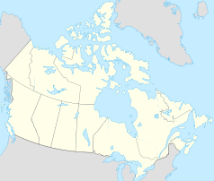
cropped version of Carte administrative du Canada.svg for map location.
Flag of Canada introduced in 1965, using Pantone colors. This design replaced the Canadian Red Ensign design.
Flag of the Northwest Territories.
Autor: Algkalv and Dr. Blofeld based on original by Yug. Inset map is by EOZyo. Two maps put together by Ruhrfisch (talk) 15:00, 8 September 2010 (UTC), Licencja: CC BY-SA 3.0
Map of Northwest Territories
Autor: awmcphee, Licencja: CC0
This vacant lot is actually an Indian reserve, situated at Fort Smith's central intersection. Salt River First Nation has taken a fairly active role in development around town. These banners adorn various other SRFN properties, too.


