Forth Bridge

Forth Bridge
Ilustracja
Forth Bridge od południa (2012)
Państwo

 Wielka Brytania

Kraj

 Szkocja

Miejscowość

Queensferry/North Queensferry

Podstawowe dane
Przeszkoda

Firth of Forth

Długość

2 528,7 m

Data budowy

1882–1890

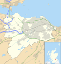
Położenie na mapie Edynburga
Mapa konturowa Edynburga, u góry po lewej znajduje się punkt z opisem „Forth Bridge”
Contains Ordnance Survey data © Crown copyright and database right, CC BY-SA 3.0
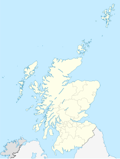
Położenie na mapie Wielkiej Brytanii
Położenie na mapie Szkocji
Ziemia56°00′01,516″N 3°23′19,414″W/56,000421 -3,388726
The Forth Bridge[a]
Obiekt z listy światowego dziedzictwa UNESCO
ilustracja
(c) George Gastin, CC BY-SA 3.0
Państwo

 Wielka Brytania

Typ

kulturowy

Spełniane kryterium

I, IV[1]

Numer ref.

1485

Region[b]

Europa i Ameryka Północna

Historia wpisania na listę

Forth Bridgemost kolejowy we wschodniej Szkocji, przerzucony nad zatoką Firth of Forth, pomiędzy miejscowościami Queensferry i North Queensferry. Wraz z biegnącymi równolegle mostami drogowymi Forth Road Bridge i Queensferry Crossing zapewnia komunikację między Edynburgiem na południu a hrabstwem Fife na północy. Most, według projektu inżyniera Johna Fowlera, zbudowano w latach 1879–1890. W 2015 roku został wpisany na listę światowego dziedzictwa UNESCO[2].

Portret Johna Fowlera, projektanta Forth Bridge

Konstrukcja

W trakcie budowania mostu

Most o długości całkowitej wynoszącej 2,5 kilometra składa się z trzech masywnych filarów o konstrukcji kratownicowej w kształcie rombu oraz czterech mniejszych wiaduktów. Każdy romb ma 110 metrów wysokości, natomiast rozpiętość pomiędzy nimi wynosi 521 metrów.

Ruch pociągów przebiega w odległości 50 metrów od lustra wody, co praktycznie uniemożliwia wpływanie większych statków w głąb lądu. Do budowy zużyto około 54 000 ton stali, którą zamocowano przy użyciu 6,5 mln nitów.

Przypisy

  1. The Forth Bridge, UNESCO World Heritage Centre [dostęp 2017-11-23] (ang.).
  2. Wpis na listę UNESCO


Media użyte na tej stronie

United Kingdom adm location map.svg
(c) Karte: NordNordWest, Lizenz: Creative Commons by-sa-3.0 de
Location map of the United Kingdom
IconBridge-bk.svg
Autor: Tzugaj, Licencja: CC0
Ikona mostu do legendy mapy.
Flag of UNESCO.svg
Flag of the United Nations Educational, Scientific and Cultural Organization (UNESCO)
Forth Bridge - Superstructure, Fife, 15 Sept. 1886.jpg
Photograph of the Fife superstructure (lifting girders and platforms). Owing to the fact that the Fife cantilever occurs on the foreshore and is overlooked by rising ground to the north, it afforded an opportunity of obtaining certain views not practicable in the case of the other two. Not only did its situation admit of perspective effect being duly emphasised, but also that of the rectangular form of the structure, only apparent when each vertical column is separately defined. The cages before referred to are all seen here in position prior to the first lift. Up to this level the superstructure was erected by means of ordinary cranes and staging. In the vertical columns and at a height of about 30 feet above the surface of the pier, a plate was omitted on either side of the same. In the gap thus formed were built two box girders, having a dimension of about 5 feet by 2 feet. Superimposed upon these girders were what were subsequently known as the lifting platrofms - comprised of material destined to be ultimately worked into the permanent structure - and through which the upper ends of the vertical tubes and struts projected. The total weight of these four girders and their accessories amounted to about 400 tons, the whole being supported by and lifted from the vertical columns in the following manner:- Inside each of these columns were constructed two frames, the upper side of the one being connected to the lower of the other by means of hydraulic jacks contrived in such a way as to oscillate in a plane at right angles to the centre line of the bridge. Through the rigs of the columns holes were drilled at equal distances apart, and into these holes steel pins were inserted supporting either frame. Everything being ready for a lift the jacks were set in motion, the thrust being taken by the lower frames and duly transmitted to the pins. At the end of the stroke pins were inserted below the under side of upper frame and the jacks eased, whereupon the whole weight of the platform came upon the upper frame, the lower one, simultaneously drawn up by the closing of the jacks and secured by pins, being at once in readiness for another lift. The rate of progress was to a large extent governed by the weather, but under favourable circumstances it was extremely rapid, as many as three lifts having been effected in eight days, and the necessary riveting accomplished in the cages attached. The tension girder connecting the vertical columns from east to west is noticeable in the foreground of the picture, as is also a part of the diagonal bracings, which is designed to afford the principal support fo the internal viaduct. The gallows so conspicuous above the vertical columns on the lifting-platforms answer the purpose of cranes and were employed in lifting and holding the plates in position until temporarily bolted. The means of access to the upper part of the structure, independently of lifts, is shown in the staircase running up the diagonal bracing and subsequently continued in a similar fashion to the full height of the superstructure. Transcription from: Philip Phillips, 'The Forth Railway Bridge', Edinburgh, 1890.
Edinburgh UK location map.svg
Contains Ordnance Survey data © Crown copyright and database right, CC BY-SA 3.0

Blank map of Edinburgh, UK with the following information shown:

  • Administrative borders
  • Coastline, lakes and rivers
  • Roads and railways
  • Urban areas

Equirectangular map projection on WGS 84 datum, with N/S stretched 175%

Geographic limits:

  • West: 3.47W
  • East: 3.05W
  • North: 56.05N
  • South: 55.80N
The Forth Bridge seen from South Queensferry.JPG
Autor: Kim Traynor, Licencja: CC BY-SA 3.0
The Forth Bridge seen from South Queensferry
Forth Bridge (1890) Portrait of John Fowler, Plate 1.jpg
Forth Bridge (1890) Portrait of John Fowler, Plate 1
Forthrailbridgefromsouthqueensferry.jpg
(c) George Gastin, CC BY-SA 3.0
A late night view of the Forth Rail Bridge from the shore of South Queensferry