Frövi
| ||||
 Centrum Frövi (2014) | ||||
| ||||
| Państwo | ||||
|---|---|---|---|---|
| Region | ||||
| Gmina | ||||
| Powierzchnia | 2,52[1] km² | |||
| Populacja (2018) • liczba ludności • gęstość | ||||
| Portal | ||||
Frövi – miejscowość (tätort) położona na terenie gminy Lindesberg w regionie administracyjnym Örebro w Szwecji.
Opis
Miejscowość leży ok. 10 kilometrów na południe od Lindesbergu, nad rzeką Arbogaån. 29 sierpnia 1857 roku uruchomiono z Frövi połączenie kolejowe, obsługiwane przez towarzystwo kolejowe: "Köping-Hults Järnväg", które stanowiło fragment trasy Örebro–Frövi–Arboga[2]. 16 listopada 1871 roku wraz z otwarciem przez "Svenska Centralbanan" połączenia kolejowego: Frövi–Ludvika, miejscowość awansowała do rangi kolejowego węzła komunikacyjnego[3]. W 1874 otwarto istniejący do dzisiaj dworzec kolejowy. Obiekt od 2008 roku jest własnością prywatną[4].
Największym pracodawcą jest założona pod koniec XIX wieku fabryka papieru: "Papierfabrik Frövifors", która obecnie jest częścią koncernu: "BillerudKorsnäs AB". Kiedy w latach 70. XX wieku wybudowano nowe obiekty na terenie fabryki, poprzednie zabudowania fabryczne zachowano i przekształcono w muzeum[5].
Przypisy
- ↑ a b c Statistiska tätorter 2018; befolkning, landareal, befolkningstäthet (szw.). Statistikmyndigheten SCB, 2020-03-20. [dostęp 2020-09-08]. [zarchiwizowane z tego adresu (2020-03-24)].
- ↑ Historik ÖKJ, Örebro - Köpings Järnväg, Köping - Hults Järnväg, KHJ .Facts about ÖKJ, www.historiskt.nu [dostęp 2019-02-10].
- ↑ Historik FLJ, Frövi - Ludvika Järnväg .Facts about FLJ, www.historiskt.nu [dostęp 2019-02-10].
- ↑ Våra fastigheter, 2007 - s. 22, 2008 - s. 28-29, Jernhusen [dostęp 2021-09-28] (szw.).
- ↑ Frövifors Pappersbruksmuseum, Frövifors Pappersbruksmuseum, 18 lutego 2014 [dostęp 2019-02-10] (szw.).
Media użyte na tej stronie
(c) Lokal_Profil, CC BY-SA 2.5
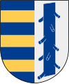
This coat of arms was drawn based on its blazon which – being a written description – is free from copyright. Any illustration conforming with the blazon of the arms is considered to be heraldically correct. Thus several different artistic interpretations of the same coat of arms can exist. The design officially used by the armiger is likely protected by copyright, in which case it cannot be used here.
Individual representations of a coat of arms, drawn from a blazon, may have a copyright belonging to the artist, but are not necessarily derivative works.
Autor: Erik Frohne, Licencja: CC BY 3.0
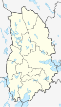
Location map of Örebro County in Sweden
Equirectangular projection, N/S stretching 196 %. Geographic limits of the map:
- N: 60.20° N
- S: 58.60° N
- W: 14.10° E
- E: 15.90° E


